Geology Reference
In-Depth Information
5
Short-term deformation:
geodesy
Owing to plate motions, radioactive heat
production, and gravity, the surface of the Earth
is in constant movement at a regional scale.
Deformation of the Earth's surface as a
consequence of faulting and folding results
from differential motion of adjacent parts of the
crust or from changes in thermal buoyancy.
If contrasting velocity vectors can be resolved
for two separate locations, then the amount of
deformation that must be accommodated by the
intervening region can be determined. Con-
sequently, delineation of the regional pattern of
crustal motion and the recognition of differences
from one area to the next serve to pinpoint
where and how much tectonic deformation
should be occurring. A few decades ago, for
example, transform plate boundaries were
typically conceived of as narrow, elongate zones
of focused deformation bounded by rigid plates.
With this model, a major strike-slip fault like the
San Andreas Fault was defined as the boundary
between the North American and Pacific Plates.
Today, precise surveys clearly indicate that this
plate boundary is instead a diffuse zone of
deformation more than 500 km wide (Minster
and Jordan, 1987; Molnar and Gipson, 1994;
Ward, 1990) and that the San Andreas Fault is
only one among many faults that accommodate
the relative motion between these plates.
Measurements of deformation can be made at
both regional and local scales. Whereas regional
patterns of relative and absolute crustal velocity
indicate where strain should occur and may
suggest the likely orientation of local stress fields,
local measurements of deformation due to folding
and faulting serve to characterize the style and
magnitude of the displacements that accom-
modate differential crustal velocities. Such local
information reveals how the land surface deforms
due to individual seismic events, it provides data
on the variability of displacement along the
length of any surveyed structure, and it illustrates
how the Earth's surface deforms between major
earthquakes (interseismic deformation) or in the
absence of significant seismicity (aseismic creep).
Careful measurements of local deformation,
therefore, provide insight into specific crustal
responses, such as the wavelength, amplitude,
and orientation of folding, to imposed stresses.
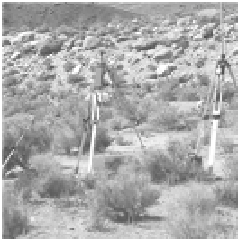
Geodesy
, as used in geological studies, is the
measurement of the exact position of geographic
points. Typically, repeated surveys are made of the
same locations, for example, before and after an
earthquake, or of specific sites in the interior of two
contiguous plates. In order to obtain the most reli-
able geodetic history of deformation, measurements
in a long time series are preferable. The duration of
such surveys is limited by the interval over which
appropriate instrumentation has been available and
the date when initial baseline measurements were
made. By comparing the geodetically determined
positions of various sites through time, both the
magnitude of spatial changes and the rate at which
they are occurring can be calculated.