Global Positioning System Reference
In-Depth Information
the database would hold information of all restaurants and fuel stations along with
their locations and opening hours, which would be useful if a service were asking
for all facilities within a 10-minute drive that are open. Titmuss et al. [21] describe
the way to preindex location information so users (who know their location)
rapidly get useful short lists of relevant information in response to their inquiries.
The most effective way, however, of dealing with structured geoinformation
(or any other information space where there is a clear, rational approach and
hierarchy) is to adopt a highly standardized approach. There are many standards
and standards bodies in mapping: we shall now look at some of the more
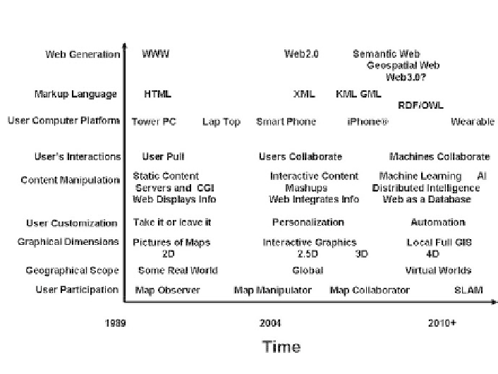
important to the Geoweb. Figure 8.3 shows how the Web and its protocols have
been changing and how the future is likely to develop with reference to maps and
GIS. (See Chapter 9 for explanations of Semantic Web that includes the use of
RDF and OWL, and the technique of simultaneous location and mapping or
SLAM.)
Figure 8.3
The Web and its evolution with respect to maps and GIS.