Graphics Programs Reference
In-Depth Information
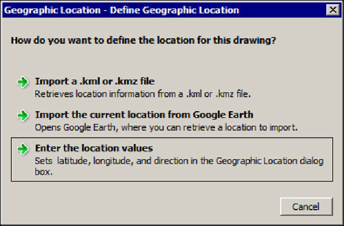
The GEOGRAPHICLOCATION command
The
GEOGRAPHICLOCATION
command (alias
GEO
) defines a geographic location
and the north direction, essential to calculate azimuth and altitude for the Sun. The
first time we apply the command, a window is displayed prompting us to choose
between three possibilities:
•
Import a .kml or .kmz file
: This imports the latitude, longitude, and el-
evation values from a KML or KMZ file. This file is an XML notation that
includes geographic information created for Google Earth.
•
Import the current location from Google Earth
: If Google Earth is
open, it imports the current location from Google Earth directly to the
scene.
•
Enter the location values
: We choose the location and the north direc-
tion on a new dialog box, as follows:
If we already have a defined geographic location, a similar box is displayed with op-
tions to edit the current location, to define a new one, or to delete it.
Search WWH ::

Custom Search