Geology Reference
In-Depth Information
standing above the younger plain of the Cenral
Plateau of Tanzania. On the other hand, Qu ennel
et
al. (1956) regard the greater part of the Cenral
Plateau to be the African surface which they des-
cribe as being of mid-Teriary age. However,
these authors state that the Cenral Plateau region
was uplifted on two occasions
n
post-Jurassic
ime with the second phase, which probably con-
inued through the Neogene, disruping the Afri-
can surface.
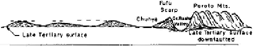
Recognising the verical movements, King
(1967) observes that the same topography associ-
ated with the late Teriary surface has been
down-faulted east of the Fufu scarp to form the
floor of the Great Ruaha Valley (Figure 2.9b). In
D
Basins
ll
Swells
�
Fold Mts.
conrast, the up-aulted Southen Highlands that
bound the valley to the southeast bear the early
Teriary planaion (African Surface), and above it
stand residuals of the Gondwana surface ofJur-
assic age. Eastwards of the fault-bound Southen
Highlands to Liwale, the African surface
s
dominant. Towards the coast there is a con-
vergence of these different erosional surfaces as
they pass beneath marine sediments of different
ages, demonstraing a coastal monoclinal flexure,
or down-warp.
Westwards of the high areas of Uganda,
Rwanda and Burundi, plains are again the
dominant landform. Some of the plains have
clearly been formed by the deposiion of sedi-
ments, especially in some of the large sructural
• '
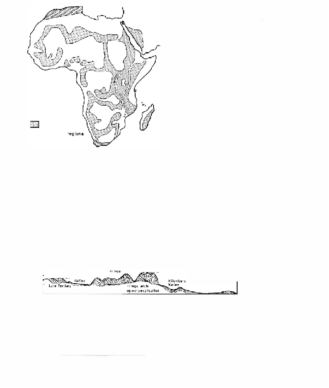
Figure 2.8. The major basins and swells of Africa (after
Hohnes, 1965:
p.
1054).
of easten African tectonics have lowered some
areas and raised others, daing the plains is not a
simple correlaion oflevels (Figures 2.6 and 2.9a,
b) . Accordingly, authors do not always agree about
the absolute or relaive ages of paricular plains.
In King's view (King, 1967), the Masai steppe
and Serengei Plains are preserved as representa-
ives of the early Teriary (African) surface, while
only remnant summits of this surface remain
Udzungwa
Mis
W (a)
E
Summits African surface
(m)
2000
Li.le Tertiary
Ru.ha
Coast
Kibiti
r�L.�1.�r�er�1;.. "
y
�-�-�-�A���
��-_
_
,
downfautted
1
000
NNW (b)
(m)
2000
Lake Victoria
lnselbergs bearing African surfacl'
Tabora
.__.�_-
� -..��---
_-
� ;:..-
-.-
- -
:;.
1000
Figure 2.9(a). Generalised secion across he Southen Highlands of Tanzania. (b)
Generalised secion across the Cenral Plateau of Tanzania showing erosion suraces.

Search WWH ::

Custom Search