Information Technology Reference
In-Depth Information
In addition to the attribute data, the grid of maps is displayed in a separate geo-registered PDF index
map. Each map sheet name is displayed within the grid. The same database of coordinates is then used to
place a hyperlink at each map name location, allowing users to navigate through the entire map set by point
and click. This same data are used to create hyperlinks at the edge of each map sheet, which allows users to
move between adjacent maps by clicking on the edges.
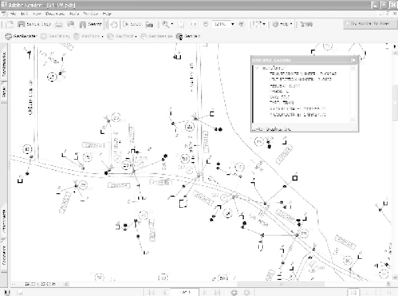
Figure 14.4
GeoPDF with embedded feature data
Hyperlinking Data
Since the index map is geo-registered, address range data, which contains coordinates of street address
ranges and street intersections, can be utilized to enable zooming to those locations. The locations are read,
and a bookmark for each street intersection and address location is created in the Bookmark pane of the
index map.
While rendering the AutoCAD files to PDF and providing them to any computer that has Adobe Reader
installed is a great benefit, the additional functionality enabled by the use of Geode is an order of magnitude
improvement. What was formerly a simple paper analog has now become a distribution method for the full
range of data contained in the NGEMC corporate GIS.
References
[1]
Warnock, John.
The Camelot Project.
1991. With permission of the author, the PDF document is available at
PlanetPDF, http://www.planetpdf.com/mainpage.asp?webpageid=1851.
Search WWH ::

Custom Search