Geography Reference
In-Depth Information
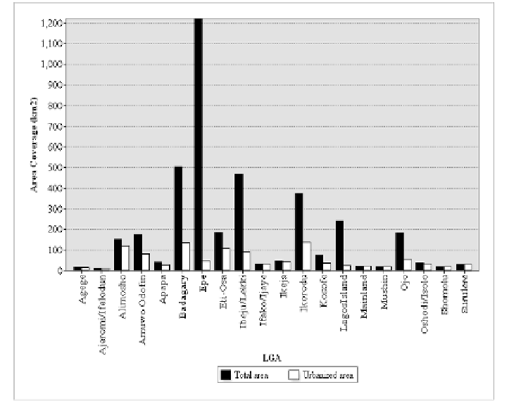
Figure 14. Side-by-side comparison of the administrative areal extent and urbanized
area.
Table 5 provides basic planning information and this is a result of GIS-
assisted query technique within the created geo-database. From this database
system, it is possible to retrieve non-attribute information as it relates to its
spatial constituent pertaining to a particular local administrative area and
further narrowed down to specific vulnerability class.
However, the various derivatives and spatial information generated from
this analysis demonstrate the capability of GIS-based system supported by
multi-scale remote sensing and temporal data for mapping and identifying vital
components exposed to the impact of flooding. The modeling methodology
proposed in this chapter is beneficial for both local and holistic flood risk
modeling and offers a significant degree of accuracy and simplification in
contrast to pure hydrological flood risk and prediction model which has been
criticized for its complexity with respect to the nature of data, preparation,
rigorousness of procedure and computational time (Sanyal and Lu, 2004;
Taubenbock et al., 2011).