Geography Reference
In-Depth Information
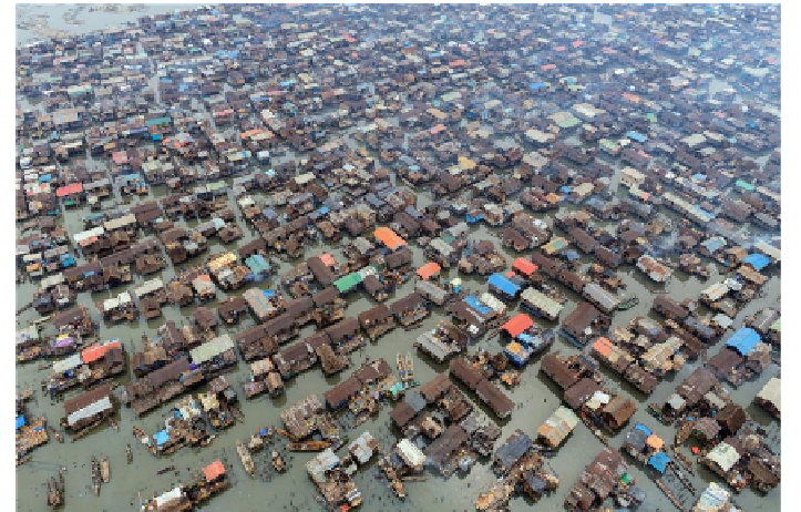
Figure 2. An aerial view of Makoko slum settlement on the Lagos Lagoon.
In 2010 and 2012, properties estimated to worth millions of Nigeria Naira
were ravaged in Ikorodu axis as a result of the River Ogun persistent overflow
and the heavy rainfall induced Atlantic Ocean rise forced the Lagos Lagoon
waters to rise above its actual channel and flow into the River Ogun flood-
plain. The flood water submerged and ravaged major roads and residential
buildings (Figure 3).
It was reported (Akinsanmi, 2011) that River Ogun in October 2011 rose
up to 4 meters as a result of the incessant rainfall in the south western part of
the country (particularly Ogun State), this led to an overflow of the river into
surrounding towns such as Mile 12, Owode-Onirin, Agiliti, Isheri North, Maji-
dun, Egbeda etc. In 2013, Lekki, a high density activities area of Lagos State
was affected by tidal flood. The flood water also found its way into Jakande
Estate, Lekki Beach and Elegushi areas.
The Lagos State government have put numerous measures in place to
check the hazard which include cleaning up of block municipal drainages,
construction of canals and storm water channels, demolition of illegal
structures (especially those located along stream channels), fortification of the
beach line to mitigate the effect of ocean surge and coastal erosion, early flood
warning and enlightenment campaign.