Geography Reference
In-Depth Information
copertura
(attenuation potential of the soil),
A
quifero
(hydrogeologic
characteristics of the aquifer),
C
onducibilita
(hydraulic conductivity) and
S
uperficie topografica
(topographic slope). However, the SINTACS method is
more flexible to ratings and weights of the parameters than DRASTIC method.
Table 7. Relationship between Aquifer Vulnerability Index (AVI)
and hydraulic resistance
Hydraulic Resistance (c)
Log(c)
AVI
0-10 year
<1
Extremely High
10-100 year
1-2
High
100-1000 year
2-3
Moderate
1000-10000 year
3-4
Low
>10000 year
>4
Extremely Low
After Stempvoort et al., 1992.
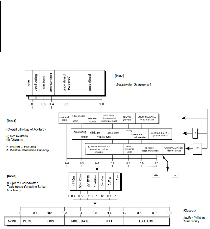
After Foster, 1987.
Figure 7. Schematic of GOD method for assessing aquifer pollution vulnerability.