Geography Reference
In-Depth Information
spatially proximal active faults, e.g., plate boundaries or seismic blocks (the
groups can be revealed in the same way as detecting aftershocks, swarms, or
clusters of earthquakes; spatial pattern recognition; migration of seismicity
center, etc. [76]).
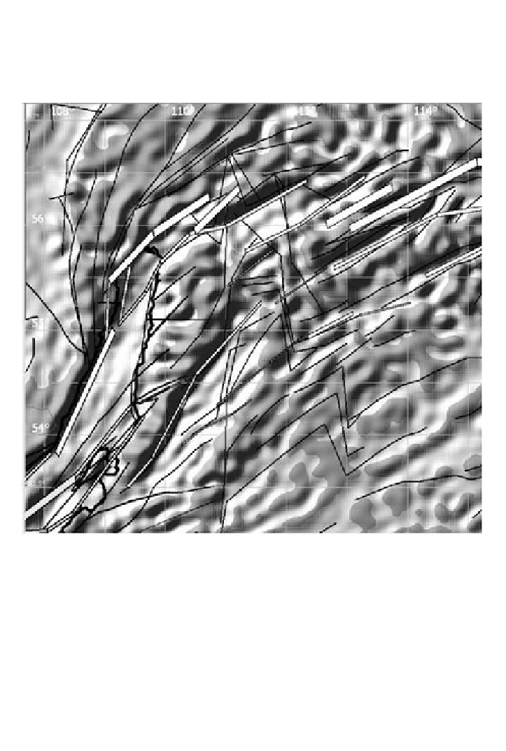
Figure 37. Gravity anomaly according to ENDDB along the boundaries of seismic
blocks delineated by faults (black lines) and seismic lineaments (white bands
according to [77]) in the northern Baikal Rift Zone. Dark color shows gravity highs or
shadow.
For example, the algorithm for recognition of linear patterns (images) by a
set of points distributed in space can identify some real straight and curved
tectonic structures [78]. The algorithm implies setting up the maximum
stepsize and deflection angle to find the next point in the chain of events on a
seismic border. Thus, identified structures can be confirmed by geophysical
data. Furthermore, the ENDDB geological-geophysical database contains
layers of seismic lineaments, faults and trenches, which can indicate whether a