Geography Reference
In-Depth Information
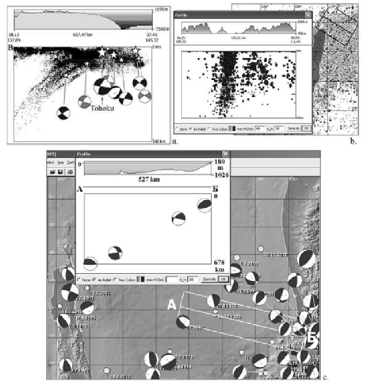
Figure 8. Vertical cross sections of topography and seismicity in Northeastern Japan,
offshore area around the Tohoku earthquake (a), the North Baikal region (b), and area
of the Pacific subduction zone (c).
Clustering of earthquakes (grouping according to their relations) is
another method of spatial data analysis. The earthquake clusters are associated
with natural localization of seismicity in zones of active faulting, e.g., along
boundaries of plates or blocks. Clustering of earthquakes has implications for
the pattern of seismicity, which then can be compared to locations of
geological structures. To reveal earthquake clusters, the user has to specify the
maximum space and time distance between events in all pairs (
dT
for time and
dS
for space) and the type (temporal or spatial) of clustering.