Geography Reference
In-Depth Information
c
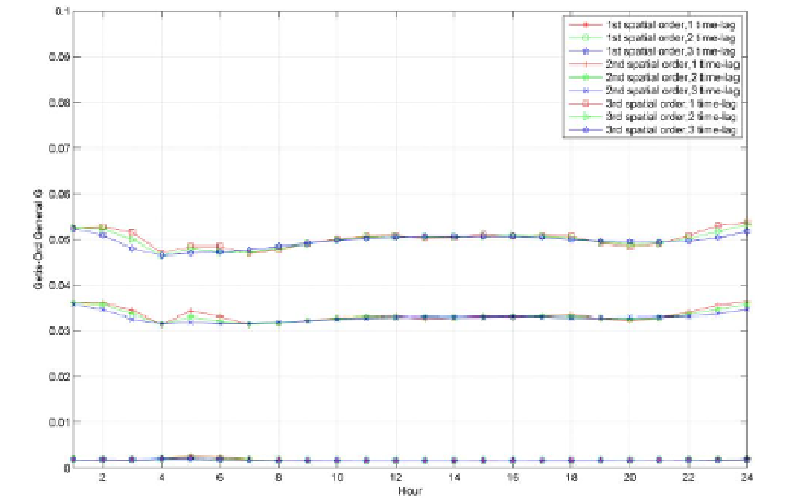
Figure 14. Three global measures of spatio-temporal association with different combi-
nations of spatial weights (spatial orders) and temporal neighbors (1 time-lag: 1 hour; 2
time-lag: 2 hours; 3 time-lag: 3 hours) for hourly phone-call patterns: (a) I
st
; (b) C
st
;
and (c) G
st
measures
.
C
ONCLUSION AND
F
UTURE
W
ORK
In this paper, we introduce a spatio-temporal analytical framework for
exploring human mobility patterns and urban dynamics with the help of GIS.
The integration of spatial-temporal visualization, space-time density estima-
tion and spatio-temporal autocorrelation analysis can not only help to represent
spatio-temporal data visually and interactively but also offer quantitative
analytics to identify the spatio-temporal patterns (such as spatio-temporal
hotspots) in the mobile phone data. Our experiments have demonstrated that
different spatio-temporal techniques have their potential advantages but also
limitations. For instance, space-time path model is good for visual exploration
or overview of individual regular (or irregular) movement patterns but might
not be suitable for massive trajectories because of overlapping and cluttering
problems in the space-time cube. The study also demonstrates that the user's
―home‖ and ―working places‖ can be inferred based on statistical information