Environmental Engineering Reference
In-Depth Information
is also an intrinsic confusion between roads and buildings with
bitumen roofs.
The processing scheme in this case exploits the obvious
difference between these two categories: the height of the objects.
Therefore, after ISODATA classification, ''shadow'' and ''tree''
classes are isolated. No assumptions are made on the others. After
some morphological operations, such as noise removal and hole
filling, from these classes all the objects that cast shadows are
selected. All the residuals are left to the bare soil class.
Alternatively, we have also considered a simplified version of
the classification approach (Fig. 3.8) presented in Gamba and
Dell'Acqua (2006). Again, the first step is a spectral classification
of the pre-event image, focusing on four different roof types,
roads, vegetation, bare soil and shadows for discrimination pur-
poses and performed through the neuro-fuzzy network. From
that classification map the building footprints were extracted and
used to focus the post event damage analysis only on buildings.
In order to correct some errors due to misclassified pixels in
the urban area, a dilate filter has been applied to the area of
interest extracted from the classification. Then, the urban area
of the post event image has been classified in damaged and
non-damaged buildings; then each building of the available GIS
has been assigned following a majority rule. In Fig. 3.9 the result
TABLE 3.2
Confusion matrix for damage evaluation of the detec-
ted buildings in the Bam pre- and post-event Quickbird image pair.
78.71%
Strongly
Lightly
damaged
damaged
BDI
≤
0
.
6
90.48%
608
140
BDI
>
0.6
51.05%
64
146
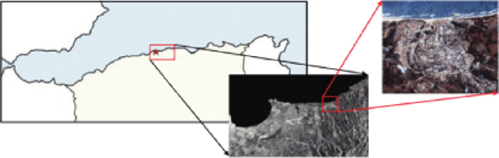
The second experimental results refer to the magnitude 6.8
earthquake occurred in northern Algeria on 21 May 2003. Cen-
tered on the Boumerdes province (Fig. 3.6) some 50 km east
of Algiers, the worst-affected urban areas included the cities
of Boumerdes, Zemmouri, Thenia, Belouizdad, Rouiba, and
Reghaia. For this event also two Quickbird images (one pre- and
one post-event) were selected.
The images were acquired on 22 April 2002 and 23 May 2003,
respectively (see Fig. 3.7). In this case, with respect to the first
test site, there is a high variability in building spectral features.
Roofs have different responses and it is not easy to isolate a
''building'' class, especially by means of unsupervised classifiers.
On the other hand is very time-consuming to specify manually
all the possible classes. As it is usual in many other cities, there
SPAIN
M E D I T E R R A N E A N S E A
ALGIERS
ALGIERS
Boumerdes
Boumerdes
ALGERIA
FIGURE 3.6
Location of the urban area of Boumerdes in Algeria.
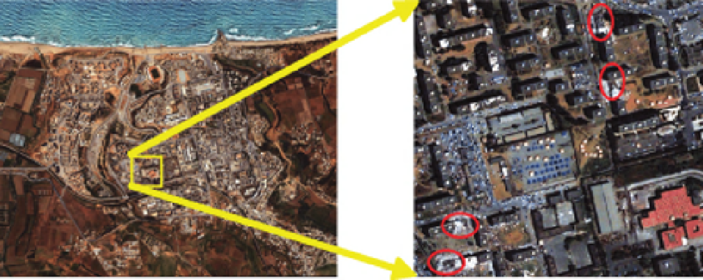
FIGURE 3.7
Post event pan-sharpened image of Boumerdes (left) and a small area of interest (right), with the collapsed
buildings highlighted in red.


Search WWH ::

Custom Search