Environmental Engineering Reference
In-Depth Information
2.3
Mapping urban spatial
growth in an American
metropolis
This rampant suburban sprawl has provoked concerns over
the losses of large areas of primary forests, inadvertent climate
repercussions, and the degradation of the quality of life in this
region (Bullard, Johnson and Torres, 2000; Lo and Quattrochi,
2003). By using population trends, land use, traffic congestion,
and open space loss, Sierra Club's 1998 Annual Report ranked
Atlanta as America's most sprawl-threatened large city (Sierra
Club, 1998).
On the other hand, because of the significant physical growth,
Atlanta's urban spatial structure and pattern have changed dra-
matically, making the city a 'hot spot' in urban studies. Urban
geographers have recognized Atlanta as one of the few typical
postmodern metropolises in North America (Hall, 2001). Soja
(1989) first used the term ''postmodern'' to describe cities that
have undergone restructuring in the United States after the rise
of post-Fordist industrial organization, which is characterized
by a flexible subcontracted production system based on small-
size and small-batch units. The postmodern city exhibits unique
urban forms, architectural styles, and socioeconomic character-
istics. Architecturally, it has multicentered business districts with
office glass towers and stylish buildings. Socially, it is increasingly
minoritized and polarized along class, income, racial and ethnic
lines (Dear and Flusty, 1998). Los Angeles is in fact a typical
postmodern city, and many cities in the United States Sunbelt are
2.3.1
Research design
In this study, we focus on the utilities of archival Landsat imagery
for urban growth and landscape change analysis with the Atlanta
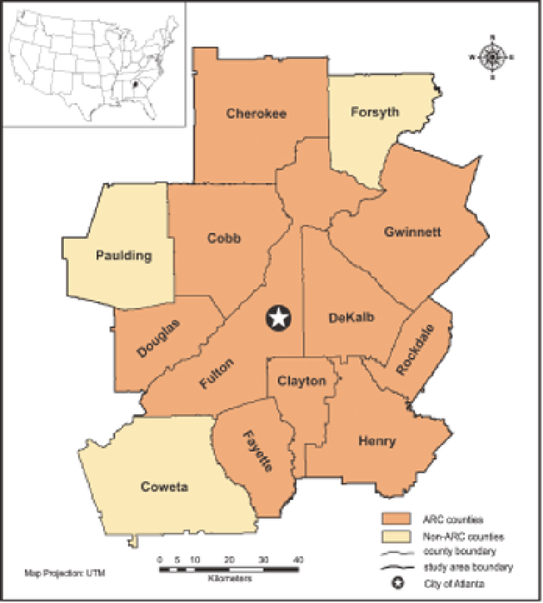
metropolitan area as a case. The study site includes the 10
counties under the Atlanta Regional Commission (ARC) as well
as three additional counties, i.e., Coweta, Forsyth, and Paulding,
which have shown a similar growth pattern to the ARC counties
(Fig. 2.1). For the past four decades, Atlanta has been one of the
fastest growing metropolises in the United States as it emerged to
become the premier commercial, industrial, and transportation
urban center of the southeast. Population increased 27% between
1970 - 1980, 33% between 1980 - 1990, 40% between 1990 - 2000,
and 36% between 2000 - 2010. The city has expanded greatly
as suburbanization consumes large areas of agricultural and
forest land adjacent to the city, pushing the periurban fringe
farther and farther away from the original urban boundary.
FIGURE 2.1
Location of the study site. It comprises the 10 counties under the Atlanta Regional Commission (ARC) plus three
additional counties (Forsyth, Paulding, and Coweta) that show a similar growth pattern. The city of Atlanta is shown.


Search WWH ::

Custom Search