Environmental Engineering Reference
In-Depth Information
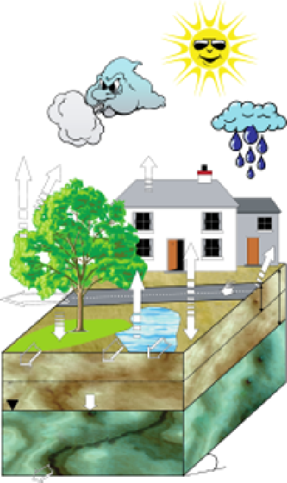
Impervious
evaporation
Transpiration
Interception
Precipitation
Bare-soil
evaporation
Open water
evaporation
Impervious
evaporation
Impervious
recharge
Vegetated
recharge
Bare-soil
recharge
Total Evapotranspiration
Impervious
runoff
Transpiration
Precipitation
Bare-soil
runoff
Open water
Vegetated
runoff
runoff
Groundwater recharge
Interception
Evapo.
Depression
Infiltration
Root zone
Groundwater
Slope
Percolation
Saturated
zone
FIGURE 18.1
Hydrological processes simulated in WetSpa model (Mohammed, 2009) (left), an example of a heterogeneous
urban cell (right).
Landuse Map
Soil Map
Digital Elevation Model
Direction
Accumulation
Slope
Roughness coefficient
Hydraulic conductivity
Stream net
Root depth
Porosity
Hydraulic radius
Interception capacity
Field Capacity
Wilting point
Evap. parameters
Velocity
Residual soil moisture
t
0
c
D
Pore distribution index
σ
WetSpa
Runoff coefficient & Depression storage capacity
FIGURE 18.2
Relationship between the three main input maps, digital elevation model, land-use and soil map, and the
WetSpa model parameters.
t
0
is the mean flow time,
c
is the celerity of the diffusion wave,
D
is the dispersion coefficient
coefficient,
σ
is the standard deviation of the flow time.
The influence of urban areas on storm runoff is self-evident.
Due to the raster resolution, cells may not be 100% impervious.
In WetSpa the remaining area is assumed to be pervious and
covered by grass, and therefore, the potential runoff coefficient
for urban areas is calculated as
area. Table 18.2 presents standard impervious cover percentages
for different land-use categories. Imperviousness percentage for
residential, commercial and industrial area is estimated based on
the information in Chow, Maidment and Mays (1988). Other
estimates are considered reasonable guesses. Zero impervious
percentage is assumed for land-use categories not listed (i.e.,
agriculture, grassland, and forest land).
The effect of rainfall duration is also included in the runoff
process, as more runoff is produced during a storm event due to
C
u
=
IMP
+
(1
−
IMP
)
C
grass
(18.2)
where
C
u
and
C
grass
are potential runoff coefficient for urban
and grass raster cells, and IMP is the proportion of impervious


Search WWH ::

Custom Search