Environmental Engineering Reference
In-Depth Information
(a)
(b)
Persons Per
Square Kilometer
Persons Living in Poverty
per Square Kilometer
Voting Districts
County
0
304.7
-
825.6
825.7
-
1,346.4
1,346.5
-
2,257.9
2,258.0
-
3,768.4
3,768.5
-
6,945.6
0
8
-
56.1
N
56.2
-
168.3
168.4
-
368.7
368.8
-
673.3
673.4
-
2,043.9
W
E
S
0
5
10
20
Kilometers
Classification in Jenks Natural Breaks
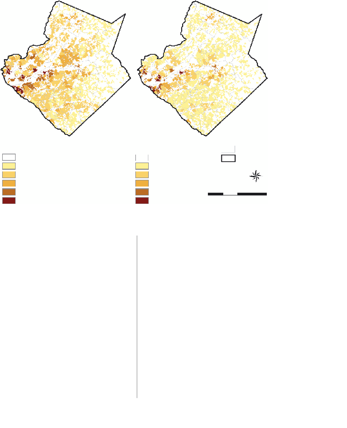
FIGURE 14.5
Dasymetric maps for Gwinnett County: (a) population density; (b) poverty density.
usage amongst the GIS user community. It is argued that to
encourage greater uptake such methods must offer simplicity
and convenience'' (Langford, p. 19).
It is our contention that the binary dasymetric mapping
method, both as a cartographic tool as well as a means for
performing areal interpolation, provides accurate results and can
be easily implemented using current GIS software applications
with custom geoprocessing scripts or off-the-shelf extensions,
such as that provided by USGS for ArcGIS. Furthermore, the
availability of ancillary data such as the NLCD 2001 and other
remote sensing derivative products now indicates that GIS users
no longer need to be remote sensing experts in order to conduct
dasymetric mapping. For example, Reibel and Agrawal (2007)
performed dasymetric mapping using NLCD data and they
found that this easily-obtainable dataset, which does not require
image processing by the end-user, performed quite well for areal
interpolation. The challenge for the remote sensing community
may be to continue developing image processing techniques
that will foster the proliferation of LULC data and increase the
accuracy of those data.
Conclusions
Dasymetric mapping results in a more accurate representation
of the magnitude and spatial extent of a phenomenon. It facil-
itates, and is the most accurate method for performing, areal
interpolation. It preserves the pychnophylactic property, and
is applicable across spatial scales. Recent research has focused
on new approaches to classifying LULC, such as object-based
analyses, texture measurements, and fuzzy classification, which
may result in increased accuracy and precision in modeling pop-
ulated land areas and may also overcome difficulties in using
very high resolution satellite imagery. Other research has focused
on improvements in measuring and estimating statistical rela-
tionships between various LULC classes and population, thus
adding more intelligence to ancillary data. In this regard, incor-
poration of additional ancillary data, such as cadastral data, and
the refinement of regression modeling approaches that address
the existence of spatial nonstationarity (Langford, 2006; Lo,
2008) have been demonstrated to be useful. In addition, recent
developments in GIS technology and computing capacity, along


Search WWH ::

Custom Search