Environmental Engineering Reference
In-Depth Information
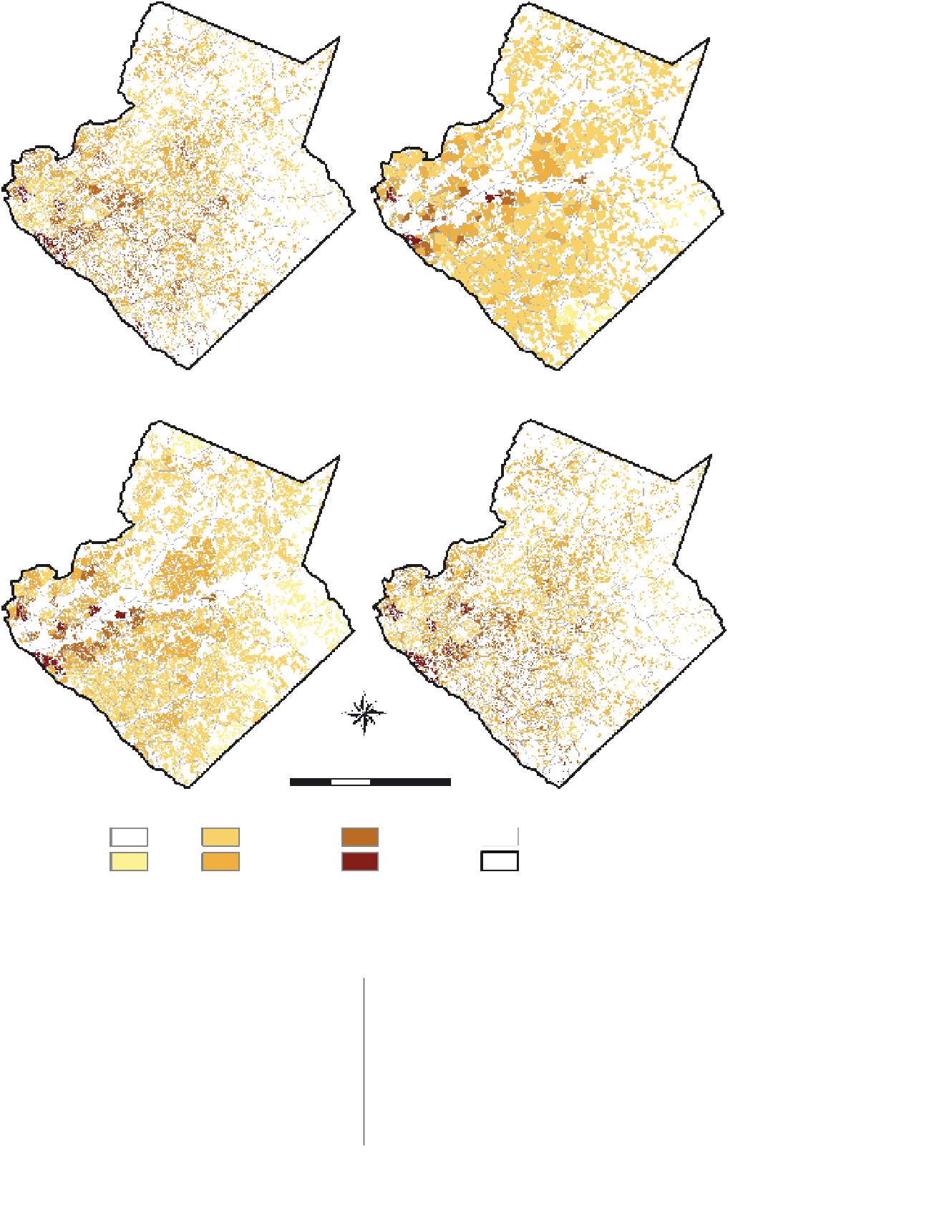
(a)
(b)
(c)
(d)
N
W
E
S
0
5 0
20
Kilometers
Persons Per Square Kilometers
0
<
500.1
-
1,500
1,500.1
-
3,000
3,000.1
-
5,000
> 5,000
Blockgroups
County boundary
=
500
FIGURE 14.3
Dasymetric maps of population density by block group for Gwinnett County: (a) binary method using NLCD
2001; (b) binary method using LandPro 2001; (c) binary method using 2001 parcel data; (d) N-Class method using Dasymetric
Mapping Extension and NLCD 2001.
need to apply the mask of highways, parks, and other similar
features (as was necessary for the NLCD layer). Our defini-
tion of residential area, using the LandPro ancillary data was:
1
=
residential area (LandPro codes: Low Density Single Family
Residential [111], Medium Density Single Family Residential
[112], High Density Residential [113], Multifamily Residential
[117], and Mobile Home Parks [119]), and 0
(parcel codes: Residential SFR [101], Residential Duplex [102],
Residential Triplex [103], Residential Quadplex [104], Mixed
Residential/Commercial [105], Condominium - Common Ele-
ment [106], Condominium - Fee Simple [107], Mobile Home
[108], Apartments - Three Story and Under [211], and Mobile
Home Park [213]), and 0
=
non-residential area (all other
parcel codes). Figure 14.3b and c depict the block-group pop-
ulation densities using the LandPro and parcel data, respec-
tively.
=
non-residential
area (all other LandPro codes). Our definition of residential area,
using the Gwinnett County parcel data was: 1
=
residential area


Search WWH ::

Custom Search