Environmental Engineering Reference
In-Depth Information
classified as single-family dwelling, multifamily dwelling, or other
non-residential land use types. While at the coarser level, build-
ings were classified as either residential or other non-residential
land use types. In order to investigate the aforementioned ques-
tions, a number of automated building extraction and land use
classification methods were developed. In addition, the impact
of the errors arisen from the remote sensing analysis to the final
population estimation was quantitatively assessed.
12 square miles), representing 4.5% of the entire city area. A
major interstate highway, IH-35, runs south-north through the
city and splits it in two sides. The west side is dominated by
civic, commercial, as well as some residential land uses located
in the northern and southern ends. In total of 1153 census
blocks fall within this area with over 15 000 residential buildings
(representing 85% of the total). In this area, residential buildings
correspond primarily to single-family detached and two-family
attached (94%), and secondarily to multifamily three/fourplex
and apartment/condo (6%).
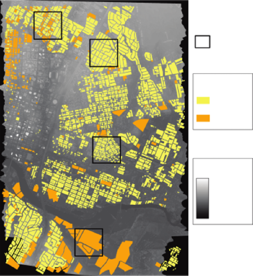
In order to perform detailed analysis of building detection
and land use classification methods, we selected four small study
areas within the larger study area. The inset boundaries are shown
in Fig. 13.1. These sites were carefully selected to represent the
wide spectrum of living environments found in the study area:
13.2
Study sites and data
The study area is located in the city of Austin, Texas. Austin is
currently the third fastest growing large city in the United States
with a population of 750 000. According to the US Censuses
of 1990 and 2000, the city grew an impressive 41% (from
465 622 in 1990 to 656 562 in 2000), with an average annual
growth rate of 3.5%. The city's population has been projected
to top 800 000 by 2010 (City of Austin, 2009a). The selected
area for this study covers approximately 4
.
8
×
6
.
4km(nearly
●
Inset 1 contains multifamily dwelling units located in a
sparsely vegetated area,
Inset 2 contains single-family dwelling units located in a
densely vegetated area,
●
Inset 4
Insets
Inset 2
Land use types
Single-family
Multi-family
Inset 3
Elevation (m)
High:596.52
Low:0
Inset 1
FIGURE 13.1
Location of the four insets in the study site. Background are lidar data second return and land use types.


Search WWH ::

Custom Search