Environmental Engineering Reference
In-Depth Information
(a)
(b)
(c)
(d)
20 km
0%
100%
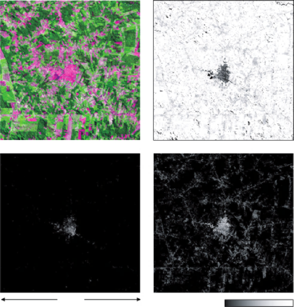
FIGURE 8.4
Shade-normalized V-I-S fractions for the settlement of Buritis, Rondonia, located in the center of the subscene.
(a) False color composite of 2001 Landsat ETM+ sub-scene bands 543; (b) Vegetation fraction (GV + NPV); (c) Impervious
fraction; (d) Soil fraction.
reflectance were considered, (b) themaximum shade fractionwas
constrained to 0.55, and (c) theminimumbright (i.e., non-shade)
fractions allowed was 0.10. Model constraints were determined
by experimentation and visual inspection of resulting fraction
and RMS error images. In particular, assessment was facilitated
by the
apriori
assumption that impervious fractions should be
spatially constrained in the region of built-up land cover, and
conversely, impervious surfaces shouldbe a near-zero component
of other land-cover types. Constraints were therefore chosen
that minimized impervious fraction ''speckle'' in non-built-up
land-cover types (e.g., pasture, primary forest).
Selection rules:
The model with the lowest RMS error was
selected for each level of complexity. To determine the over-
all best-fit model, lower complexity models were favored, and
higher complexity models were selected only if their RMS error
was significantly lower. A threshold of 0.25% was empirically
determined to be a ''significant'' difference (Roberts
et al
., 2003;
Powell and Roberts, 2008).
Results:
The final products of this analysis were shade-
normalized fraction images for each generalized material type
(V-I-S). GV and NPV fractions were combined in the vegetation
layer, as their relative composition is related to the strength of
the wet season that year, as well as the length of the dry sea-
son relative to the date of image collection. Shade-normalized
fractions for the settlement of Buritis in 2001 are presented in
Fig. 8.4. High fractions appear bright, and low (or zero-value)
fractions appear dark. The vegetation component (Fig. 8.4b) is
quite low in the urban center, higher in pasture areas (which are
a mixture of GV and NPV), and highest in forested areas (which
are dominated by GV). Impervious fractions (Fig. 8.4c) are con-
centrated in the urban land cover in the center of the image, and
are near-zero in the rest of the image. Soil fractions (Fig. 8.4d)


Search WWH ::

Custom Search