Geoscience Reference
In-Depth Information
24
23
22
21
20
19
18
17
2
4
8
16
32
64
overview levels
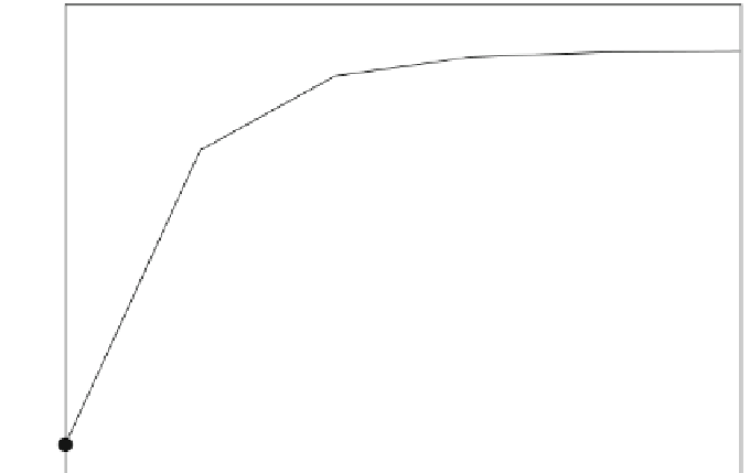
Fig. 7.3
Increase in file size (overhead) by adding more overview levels using
gdaladdo
7.3 gdal_retile.py
The Python script
gdal_retile.py
can be used to create a pyramid of an image
(see Fig.
7.1
). You can specify the output data format, the number of levels and the
individual tile size in pixels. As an option you can create an index vector and a text
file containing the georeferencing information for each tile. The target directory must
exist. You can also extend a pyramid with more levels if it already exists within the
target directory.
Usage: gdal_retile.py [-v] [-co NAME=VALUE]* [-of out_format]
→
[-ps pixelWidth pixelHeight] [-ot
{Byte/ Int16/ UInt16/
→
UInt32/ Int32/Float32/ Float64/ CInt16/ CInt32/
→
CFloat32/ CFloat64}] [ -tileIndex tileIndexName
→
[-tileIndexField tileIndexFieldName]] [ -csv fileName
→
[-csvDelim delimiter]] [-s_srs srs_def] [-pyramidOnly]
→
[-r {near/bilinear/cubic/cubicspline/lanczos}] -levels
→
numberoflevels [-useDirForEachRow] -targetDir
→
TileDirectory input_files
-targetDir directory
The directory where the tile result is created. Pyramids are stored in subdirectories
numbered from 1. Created tile names have a numbering schema and contain the
name of the source tiles(s).


Search WWH ::

Custom Search