Geography Reference
In-Depth Information
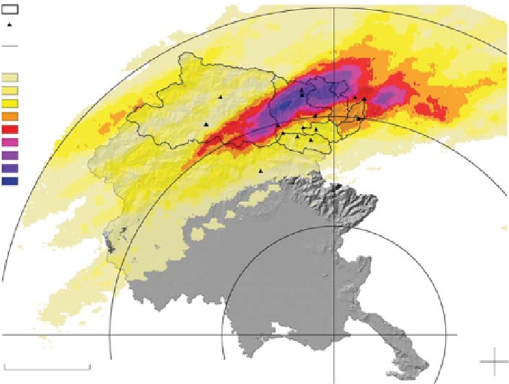
Figure 3.8. Radar-derived rainfall
accumulations for a flash flood in
north-eastern Italy in 2003.
Watershed
Rain Gauges
Rader Circle
Prec. cum. 6 Hours (mm)
10 - 30
30 - 50
50 - 80
80 - 120
120 - 160
160 - 200
200 - 270
270 - 350
> 350
E 14.1
N 45.7
50 km
1 100 000 km
2
) showed a good ability to capture daily
flood events and to represent low flows, although peak
flows tend to be biased upward (Su et al.,
2008
). This kind
of analysis demonstrates the potential of TRMM products
for hydrological forecasting in data-sparse regions at
appropriate spatial scales.
The use of ground-based radar rainfall estimation for
hydrological applications, such as runoff modelling, has
gained momentum in the past two decades with the
development of correction procedures, which are capable
of considering the highly non-linear physics of radar
detection of precipitation. Three broad areas of errors
may be identified: (i) the electronic stability of the radar
system, (ii) the determination of the detection space and
(iii) the fluctuation of the atmospheric conditions. See
Villarini and Krajewski (
2010
) for a more general dis-
cussion of error sources. When heavy precipitation in
complex terrain is considered, major sources of atmos-
pheric variability include the vertical variability of the
echo interacting with the visibility of the radar beam
(shielding by mountains and earth curvature) and signal
attenuation by rain (an important error source for X- and
C- band weather radar). The vertical profile of reflectiv-
ity induces large differences in radar measurements taken
at different altitudes. In both cases, valuable results can
be obtained by applying inverse procedures (Germann
et al.,
2006
).
Even though measured precipitation amounts from rain
gauges are generally more accurate than remotely sensed
precipitation data, rain gauges have their own error sources
The Global Precipitation Climatology Centre (GPCC)
provides monthly precipitation data sets and products from
1951 to the present, calculated from global station data
(Rudolf et al
., 2003
). The GPCC is operated by Deutscher
Wetterdienst (DWD, National Meteorological Service of
Germany) as a German contribution to the World Climate
Research Programme (WCRP).
Precipitation data from rain gauges provides an essential
reference to adjust satellite- and radar-based products. Val-
idation of remotely sensed precipitation products using in-
situ rain gauge data requires separation of the effects of
natural variability from the measurement/estimation uncer-
tainty (Ciach and Krajewski,
1999
). This, in turn, implies
the need for estimation and characterisation of the variabil-
ity in space and time across spatial and temporal scales,
which for rainfall requires specialised networks (e.g.,
Moore et al.,
2000
; Ciach and Krajewski,
2006
).
How good are precipitation data? The effective use of
satellite precipitation estimates in hydrology (e.g., Hossain
and Anagnostou,
2004
; Sorooshian et al.,
2009
) is very
much dependent upon the type of application and the
accuracy, spatial resolution, temporal resolution and
latency of the estimates: different applications have differ-
ent data requirements. For small temporal and spatial
scales, satellite-based estimates are subject to quite large
errors. For applications that imply larger spatial/temporal
scale, satellite-derived precipitation products can be of
great benefit (Yilmaz et al.,
2005
). For instance, hydro-
logical model simulations based on TRMM precipitation
input over the La Plata basins (with areas ranging up to
Search WWH ::

Custom Search