Geography Reference
In-Depth Information
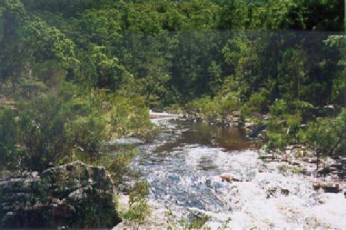
Figure 11.39. Wadbilliga River, New South Wales (95% forest
cover). NSWTI (
2012
).
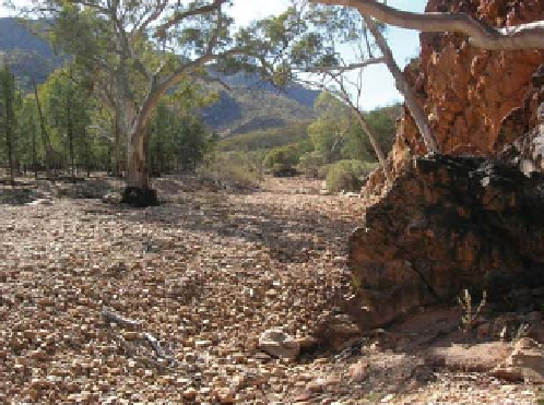
Figure 11.40. Arcoona Creek located in the semi-arid region of
South Australia.
more arid regions, basins may have little vegetative cover,
produce no runoff over most years, and yet infrequently
experience severe flooding (see
Figure 11.40
for example).
The development of regional flood estimates for the
whole of Australia has to contend with a number of special
issues: (i) the large size of the country and the substantial
degree of variation in climate and flood-production char-
acteristics between regions; (ii) a very broad range of basin
sizes; (iii) low density of population in areas away from
major cities and, associated with this, a relatively sparse
stream gauging network; and (iv) difficulty in obtaining
reliable flood gauging in remote areas.
A quality controlled national database consisting of 676
stations was prepared for the development of the ARR
RFFA method (
Figure 11.41
). The selected basins are
mainly rural with no major regulation by storages and no
significant land use changes occurring over the period of
runoff records. For the eastern states of Australia (New
South Wales (NSW), Victoria and Queensland), the annual
maximum flood record lengths of the selected stations range
from 25 to 97 years, and basin areas range from 3 km
2
to
1010 km
2
. Due to limited data availability, the minimum
threshold record length and upper limit of basin size were
relaxed for other parts of Australia to 19 years and 7500
km
2
, respectively. In preparation of the runoff data, due care
was exercised for in-filling minor gaps, detecting outliers
and accounting for rating curve extrapolation error (details
can be found in Haddad et al.,
2010
;Rahmanet al.,
2009
,
2011a
). The at-site flood frequency analysis was undertaken
using a number of alternative distributions and parameter
estimation methods, and it was found that the LP3 distribu-
tion with a Bayesian parameter estimation procedure (Kuc-
zera,
1999
) provided the best results.
Trend analysis showed that about 10% of Australian sta-
tions exhibited a downward trend in the annual maximum
Figure 11.41. Geographical distributions of the selected 676 stations
from all over Australia.
Australia. However, parts of the north-east coast receive
over 4000mm annually, with the Australian annual record
being 12 461 mm at Mount Bellenden Ker in 2000. To deal
with such climate diversity, development of RFFA
methods would ideally need recorded flood data from
many well-distributed stations with long records. How-
ever, this is not the case. As of 2006, there was 1 station
per 180 000 km
2
in the semi-arid and arid regions and 1 per
2800 km
2
in the humid regions (with a threshold record
length of 25 years and good quality data).
Australian basins vary significantly in topography, land
cover and surface geology. In areas such as south-eastern
Australia and Tasmania, many basins have extensive forest
cover (see
Figure 11.39
for example). In contrast, in the

Search WWH ::

Custom Search