Geography Reference
In-Depth Information
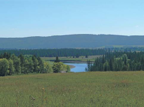
Figure 11.12. Meadow steppes and valley forests in the Lena River
basin.
Figure 11.11. Dark-coniferous forests in the Lena River valley.
the node. For each stream gauge where mean annual runoff
Q
m
was available, the total entropy of the nearest upstream
node wa
s d
etermined. The diagrams of Q
m
versus the total
entropy M
meadow-steppe vegetation alternates with pine groves, and
with larch and birch woodlands. The mountains of south-
ern Siberia are characterised by the mountain-taiga belt
occupying more than half of this territory dominated by
coniferous forests consisting of fir, spruce and Siberian
stone pine, with the inclusion of pine and larch. Higher
elevations are occupied by the high-mountain belt, with
characteristic mountain-tundra and mountain-meadow
vegetation, snow patches and small glaciers.
This diversity of natural conditions in south-eastern
Siberia is partly responsible for the differences in runoff
formation.
indicate a linear relationship within homo-
geneous regions. On the basis of this relationship, mean
an
nual runoff can be calculated at any node of the network.
M
ð
A
Þ
increases with catchment area but is more informa-
tive than the catchment area itself as it has the stream
network structure imbedded.
ð
A
Þ
Mean runoff assessment and mapping of the rivers in the
southern part of East Siberia
The input was provided by a stream network structure that
was constructed without regard for the real geometry of the
streams that constitute the river system. The network struc-
ture was constructed based on topographic maps at a scale
of 1:300 000; water streams of all orders could be taken
into account in detail at this scale.
The established relationships between structural meas-
ures (M, entropy) and average long-term discharge (Q
m
,
m
3
/s) for specific cross-sections based on hydrological
information represent a family of lines
Method
In a first step the stream network from a middle-scale
topographic map was represented as a binary tree-graph.
A binary tree-graph is a formal geometric structure where
every reach of the stream without tributaries is represented
as a link and every point of confluence is represented as a
node, irrespective of the distances involved. Second, at
every confluence the number of headwater catchments of
each of the tributaries, S
1
and S
2
, was determined. Then the
Shannon entropy was calculated in every node
α ¼
Q
=
M, repre-
sented by the numbers I
V (see
Figure 11.13
). Each of the
obtained relationships (I, II, III etc.) corresponds to a
certain area, or group of areas, characterised by a similar
set of climatic, geological and hydrological conditions. On
the basis of these, it is possible to determine the discharge
of ungauged rivers according to observable conditions. To
construct these relationships we used data from 250 stream
gauge stations in river basins: 62 sites for the Lena, 46 for
the Lake Baikal catchment, 69 for the Angara, and 73
points for the Yenisei and the Tunguskas.
For the river systems of the upper and middle parts of
the
Ye
nisei, the relationship between total structural meas-
ure M
-
H
¼ −
P
1
logP
1
−
P
2
logP
2
with
S
1
S
1
þ
S
2
S
1
þ
P
1
¼
P
2
¼
S
2
S
2
The total entropy for each node was calculated as the
sum of all entropy values upstream of the node plus H at
ð
A
Þ
and the mean discharge can be grouped into five


Search WWH ::

Custom Search