Geography Reference
In-Depth Information
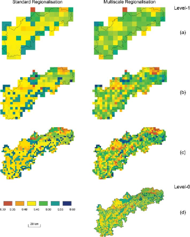
Figure 10.27. Spatial variability of
the porosity (mm/mm) of the topsoil
layer estimated from runoff by two
methods: standard regionalisation
(left) and multiscale regionalisation
(right). For the Neckar catchment.
Level-0 refers to the porosity at the
100 m scale and is provided as a
reference. From
Samaniego et al.
(2011)
.
spatial patterns of dynamic data are of particular interest
(Grayson and Blöschl,
2001
).
parameters from catchment characteristics or regional infor-
mation. Use the regionalised runoff signatures to condition
or constrain the model parameters obtained from the other
sources of information. For example, this information on
signatures in the ungauged catchment can be used to reject
all those model parameters that do not produce simulations
that are consistent with the regionalised runoff signatures.
The signatures that are suitable for this purpose depend
on the dominant hydrological processes and on which
aspect of the hydrograph one is interested in representing
particularly well. If one is interested in the distribution of
runoff within the year (e.g., for irrigation management), an
obvious choice is the seasonal runoff regime curve
(
Chapter 6
). If one is interested in low flow behaviour
(e.g., for a drought forecasting model), an obvious choice
Regionalised runoff
Chapters 5
10 of this topic have reviewed methods for
estimating runoff signatures in ungauged basins. An obvi-
ous choice for dynamic data constraining model parameters
in an ungauged basin is therefore prediction of one or more
of the signatures discussed in this topic. The basic steps of
the approach are: select and extract runoff signatures from
gauged catchments in the region; estimate the runoff signa-
tures with any of the statistical methods discussed in
Chap-
ters 5
-
runoff model at the
ungauged locations and estimate, if possible, the model
-
10;
implement a rainfall
-
Search WWH ::

Custom Search