Geography Reference
In-Depth Information
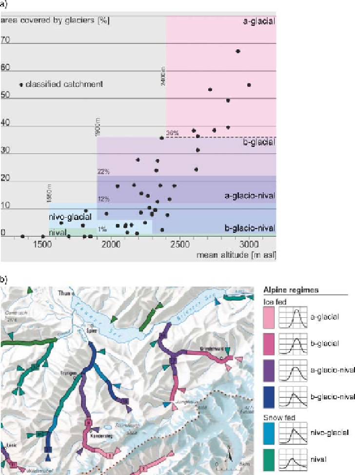
Figure 6.16. (a) Graphical
classification of the Swiss Alpine
flow regime types in the attribute
space of average elevation and
proportion of areas with glaciers.
(b) Flow regime in part of
Switzerland. The colours indicate the
regime type. The arrows represent
catchments smaller than 10 km
2
.
From the regime map in the
Hydrological Atlas of Switzerland
(Weingartner and Aschwanden,
1992
).
fraction of runoff without pronounced karstic influences
and free from human regulation is obtained using objective
methods for each element of a partition of the study area.
Estimates are obtained by temporal redistribution of annual
values, q
a
. The 12 mean monthly runoff values divided by
q
a
are first computed at each gauged location. Empirical
orthogonal function (EOF) expansion allows interpretation
of each normalised runoff pattern as a linear combination
of functions defined at the regional scale with the weights
that need to be estimated. The interpolation procedure
applied is based on geostatistical techniques adapted to
account for the related drainage basin supporting areas. This
step results in 12 maps of monthly runoff for the whole of
France, but omitting influences of karst aquifers and man-
made regulations (
Figure 6.17
). Second, corrections to esti-
mates are made to model local deviations in runoff along the
river network. The discontinuities are mainly due to human
activities and karstic aquifers, and are not well suited for
interpolation since they are not spatially organised. The
procedure considers these abrupt changes as corrections.
These corrections are deduced from downstream-gauged
basins under the constraint of water balance and assigned
to the location of the hydraulic structures or to elementary
cells controlled by karst aquifers. The categorisation of the
estimated monthly pattern at each point of the map into 12
river regime groups with Euclidean distance as similarity
Search WWH ::

Custom Search