Geography Reference
In-Depth Information
400
400
400
Beles
3431 km²
Megech
462 km²
Ribb
1592 km²
300
300
300
200
200
200
100
100
100
0
0
0
JFMAM
JJASOND
JFMAM
JJASOND
JFMAM
JJASOND
400
400
Birr
978 km²
Gumera
1394 km²
300
300
200
200
100
100
0
0
JFMAM
JJASOND
JFMAM
JJASOND
400
400
Andassa
573 km²
Abelti
15756 km²
300
300
200
200
100
100
200 km
0
0
JFMA
M
JFMAM
JJAS OND
JJASOND
400
Jinka
166 km²
400
Bilate
1980 km²
Q
P
E
P
300
300
Moisture Zone
200
200
Hyper-arid
Arid
Semi-arid
Dry subhumid
Moist
100
100
0
0
JFMAM
JJASOND
JFMAM
JJASOND
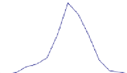
Figure 6.2. Regional differences in seasonality of precipitation (P), potential evaporation(E
P
) and runoff (Q) across Ethiopia. Colours on the
map refer to aridity classes. Courtesy: Belete Berhanu.
et al.,
1997
; Cattanéo,
2005
; Beechie et al.,
2006
; Monk
et al.,
2006
,
2007
,
2008
; Olden et al.,
2006
). The European
Water Framework Directive has formalised the need for
predictions of seasonal runoff variations within their river
water quality and ecosystem health assessment framework.
Seasonal runoff predictions in ungauged basins are also
needed to support decision making about water supply and
hydropower production (Niadas and Mentezelopoulos,
2008
; Weingartner et al.,
2012
). Estimating natural flow
regimes in catchments where runoff is already modified by
human impacts is essential for planning restoration activ-
ities (e.g., Petts,
2007
). The questions of when water is
available, how much water is available, and how reliably
these questions can be answered, are therefore key issues
for hydrologists concerned with environmental protection,
infrastructure
(hydrological year), which is termed the
'
seasonal flow
regime
for short (e.g., Harris et al.,
2000
; Bower et al.,
2004
). However, the chapter will
discuss the variability of seasonal runoff between years
as well, since it has a significant bearing on the reliability
of water resources for various human and environmental
uses. The seasonal flow regime is a valuable indicator that
can be employed in comparative studies (Falkenmark and
Chapman,
1989
) that classify and compare hydrological
signatures across regions, nations and continents.
Figure
6.2
, for example, shows runoff, precipitation and potential
evaporation (E
p
) regimes for several catchments in Ethi-
opia. The regimes indicate clear regional heterogeneity. In
the north of the country the flow regime has a single peak,
immediately following a single peak in precipitation. In
the south, there is little seasonality in runoff, and precipi-
tation is bimodal. Even without detailed knowledge of the
hydrology of Ethiopia, the flow regimes presented in
Figure 6.2
provide a basis for hypothesising the likely
'
,or
'
flow regime
'
development
and
water
resources
management.
The focus of this chapter is on the mean seasonal
pattern of
runoff variability over
the annual cycle


Search WWH ::

Custom Search