Geography Reference
In-Depth Information
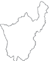
Figure 5.10. Different types
of catchment grouping to
determine hydrologically
homogeneous regions:
geographically contiguous regions
(left); non-contiguous regions
(middle); pooling group targeted to
the site of interest (right). After
Ouarda et al.(
2001
).
region 1
region 2
region 3
region 4
region 1
region 2
region 3
region 4
ungauged target site
neighbouring station
non-neighbouring station
group is homogeneous. Pooling groups, however, are
never truly homogeneous; and as the size of a group
increases, it tends to become less homogeneous. Methods
are therefore needed to optimise the group composition
and size (e.g., see Reed et al.,
1999
; Laaha and Blöschl,
2006a
).
Groups can be defined in terms of two features: (i) their
construction (fixed or targeted to the ungauged catchment
of interest), and (ii) spatial contiguity of groups (contigu-
ous or non-contiguous). Fixed groups are constructed once
during an analysis. They are intended to be globally valid
for any site in the study area. They are typically used in
index methods (e.g., groups used in the index flood method
of Dalrymple,
1960
), regression models and geostatistical
models of heterogeneous study areas. For regression
methods, the set of individual models for each group of
catchments within the study area is called a regional
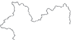
regression model. Examples of fixed groups are in the first
two study areas in
Figure 5.10
. Targeted groups are con-
structed for each site individually when a prediction is
performed for that site. They are typically used in regional
frequency analysis (e.g., flow index method or region-of-
influence approach, see e.g., Merz and Blöschl,
2005
).
Based on the idea of developing different groups for each
target site, Burn (
1990a
, b) developed the so-called region
of influence (ROI) approach, which was further refined
with the addition of a hierarchical feature by Zrinji and
Burn (
1994
). One example is the third study area at the
right in
Figure 5.10
.
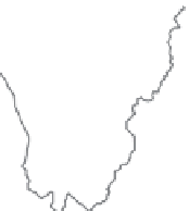
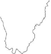
Both fixed and targeted grouping methods may lead to
classifications that are contiguous in space (regions) or non-
contiguous (groups). The study area at the left of
Figure 5.10
is subdivided into contiguous regions, while the one in the
centre is subdivided into non-contiguous regions. Methods
that yield contiguous groups implicitly exploit spatial
proximity in addition to other similarity measures. This is
advantageous in homogeneous landscapes with smoothly
varying catchment characteristics. A possible advantage of
non-contiguous groups is their greater flexibility to include
catchments that are scatted in space, but are hydrologically
similar.
In order to make predictions in ungauged sites, the site of
interest needs to be allocated to the homogeneous groups,
adding further predictive uncertainty to the analysis. For
contiguous regions this step is usually straightforward, i.e.,
ungauged catchments are allocated according to their geo-
graphic location. For non-contiguous groups, an allocation
rule needs to be defined based on available catchment
characteristics for the ungauged site. Statistical methods
such as discriminant analysis or classification trees (Laaha
and Blöschl,
2006a
) or Andrew
s curves (Nathan and
McMahon,
1990
) can be used to derive decision criteria
on the basis of available catchment characteristics from the
data set of gauged catchments. The criteria are then applied
to allocate ungauged catchments to groups.
A number of methods, called pooling methods, are used
for subdividing regions into sub-regions or catchment
groups. They differ in terms of how the groups are delin-
eated (i.e., which subjective reasoning or algorithm is
used) and what information is used (e.g., catchment char-
acteristics, catchment and runoff characteristics, seasonal-
ity, etc.) Most of the methods can be used for both fixed
and targeted grouping (see Laaha and Blöschl (
2006a
,
b
)
for
a discussion of the state-of-the-art of grouping methods
for low flows).
One example of a pooling method that involves subject-
ive reasoning is the residual pattern approach. This
approach assumes that a single model for runoff prediction
applies to the entire study area, but that regional heterogen-
eity that is not captured in the model results in localised
deviations from the predictions, called residuals. These
residuals are then mapped and, if patterns in sign and mag-
nitude are recognised, they are used to delineate contiguous
regions that are assumed to be homogeneous. In general,
'


Search WWH ::

Custom Search