Geology Reference
In-Depth Information
70
°
00'
69
°
50'
0
2 km
25
20'
°
B'
A'
N
Igneous and
metamorphic
rocks
25
°
25'
A
Alluvium
70
°
W69
°
W
Borehole
Antofagasta
24
°
0
50 km
Gravity
station
Chile
B
140
25
°
Survey
area
Contour
interval
20 gu
Taltal
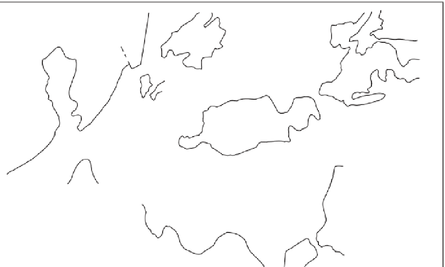
Fig. 6.28
Geological map of an area near Taltal, Chile, showing location of gravity stations and contoured Bouguer anomalies. (After Van
Overmeeren 1975.)
(a)
80
60
40
Observed anomaly
20
Calculated anomaly
(
= -0.50 Mg m
-3
)
Δρ
B Shot points
B'
0
Fig. 6.29
Profile B-B¢,Taltal area, Chile
(see Fig. 6.28 for location). (a) Observed
Bouguer anomaly and calculated
anomaly for a model with a density
contrast (
Dr
) of -0.50 Mg m
-3
.
(b) Gravity interpretation. (After Van
Overmeeren 1975.)
1
5
10
15
20
25
30
35
40
45
50
55
60
65
(b)
0
200
400
0
1
2 km