Geology Reference
In-Depth Information
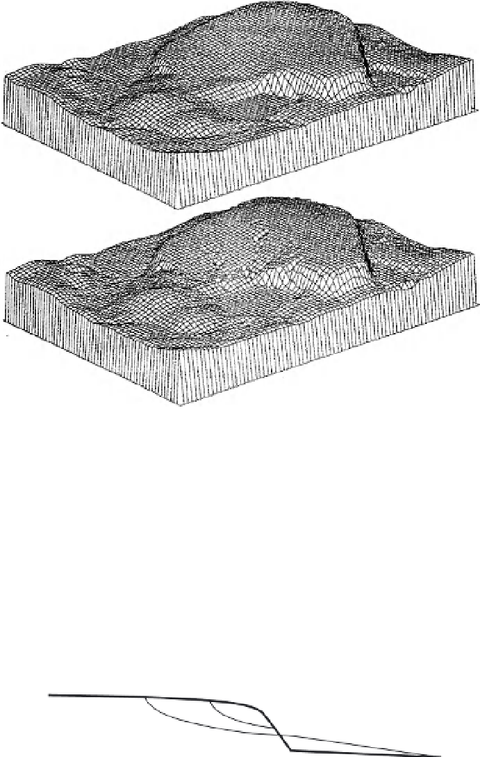
(a)
(b)
Fig. 18.1
Landform evolution simulations for the Ranger Uranium Mine, Northern Territory, Australia: (a) the
initial design landform at 0 years, and (b) the design landform after 1000 years of erosion. Some features of note
are: (1) the above-ground structure is the large doughnut-shaped structure with steep sides and flatter top in the
centre of the picture; (2) the rounded hill in the centre left foreground, that appears from this viewing angle to be
an extension of the structure, is a natural hill; (3) the large flat depression in the centre front is the rehabilitated
mine pit; and (4) the flat triangular depression in the right foreground to the immediate right of the above-ground
structure is a sedimentation basin. The approximate horizontal dimensions of the domain are 1.5 km by 1 km, the
above ground structure is approximately 25 m high, and the grid spacing is 60 m. The simulations were carried
out with a 30 m grid, but for ease of visualization only every second grid point is shown. The figure is vertically
exaggerated for clarity. From Willgoose and Riley (1998a,b).
Depth on batter at which erosion
and deposition meet
Original constructed landform
Deposition in
alluvial fan
Erosion and
gully extension
A
Natural topographic surface
Fig. 18.2
A schematic of the balance between gully erosion on the above-ground landform and alluvial fan
deposition on the surrounding natural terrain. Erosion and deposition proceed rapidly until the elevation of the
outlet of the gully reaches the elevation of the top of the fan (point A in the figure). After this time the rate of
downcutting of the gully and deposition of the fan depend on the balance between erosion and deposition, in a
complex balance involving the upstream shape of the landform into which the gully is downcutting, and the
downstream topography onto which the fan is being deposited.