Geology Reference
In-Depth Information
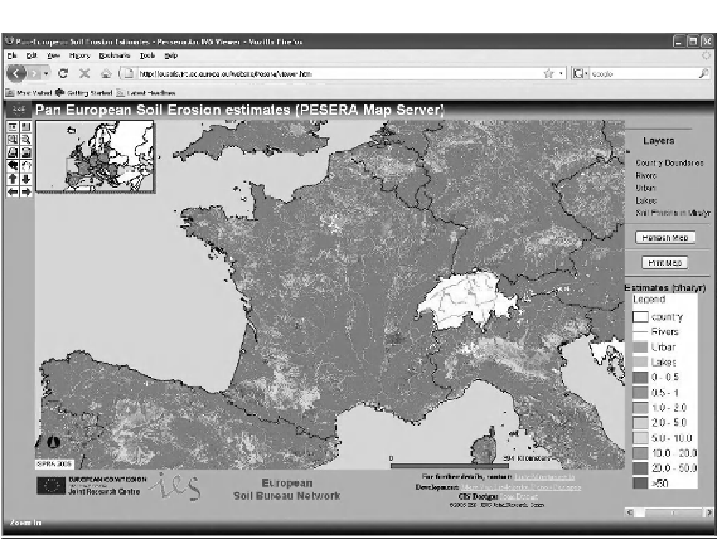
Fig. 17.1
The PESERA Map Server supported by the European Commission Joint Research Centre. The map
server is based on ESRI's ArcIMS Internet technology.
Pan European Soil Erosion Estimates Map
Server (Fig. 17.1) is an interactive application that
allows the user to navigate in the Pan European
Soil Erosion Estimates (PESERA) map and data.
The PESERA Map Server (http://eusoils.jrc.
ec.europa.eu/website/Pesera/viewer.htm) may
represent the largest internal map on erosion.
Soil erosion estimates (t ha
−1
y
−1
) are made by
applying the PESERA GRID model at 1 km, using
the European Soil Database, CORINE land cover,
climate data and a digital elevation model. The
resulting estimates of sediment loss are from ero-
sion by water. The PESERA model produces
results that depend crucially on land cover as
identified by CORINE and the accuracy of the
interpolated meteorological data.
17.5.3
Erosion model applications
One area where there has been considerable effort
is the creation of hillslope erosion model applica-
tions. In most cases the user is expected to provide
input information on the hillslope characteristics
(e.g. soil type, cover, slope gradient) and there is
little to no linkage to external databases, making
the applications self-contained. Examples of web-
based hydrological applications have been devel-
oped by scientists at the USDA Agricultural
Research Service (USDA-ARS) and by scientists
at the USDA-FS Rocky Mountain Research
Station, in Moscow, ID.
In the later 1990s the USDA-ARS Southwest
Watershed Research Center developed an