Geography Reference
In-Depth Information
time.... This work [on the SPESP] will be aiming to define a cartographic
language common to all member states and applicable to all relevant
geographical scales. (CSD, 1998b: 3)
However, during the project it quickly became obvious that agreement on a
common cartographic language was impossible.
6
This is an interesting result, given
that SPESP was somewhat detached from the political process that guided the
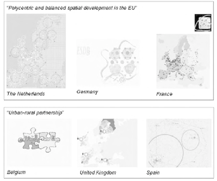
development of the ESDP. In the end, a variety of methods and images were pro-
duced, which aimed at visualising underlying spatial structures and complex func-
tional relationships in expressive and 'catchy' images, but which clearly show
different member states' approaches and understandings of the appropriate
approach to 'mapping' at this level of scale (see Figure 5.6). The Dutch and British
examples in particular are notable for a highly analytical-deductive approach to the
cartographic representation of spatial policy options, whereas others approached
the topic from a more design-led angle.
During the process the working group coined the term 'infographics' to
Figure 5.6
SPESP working group on spatial images: examples of visualising ESDP policy options
Source: CEC (2000a)