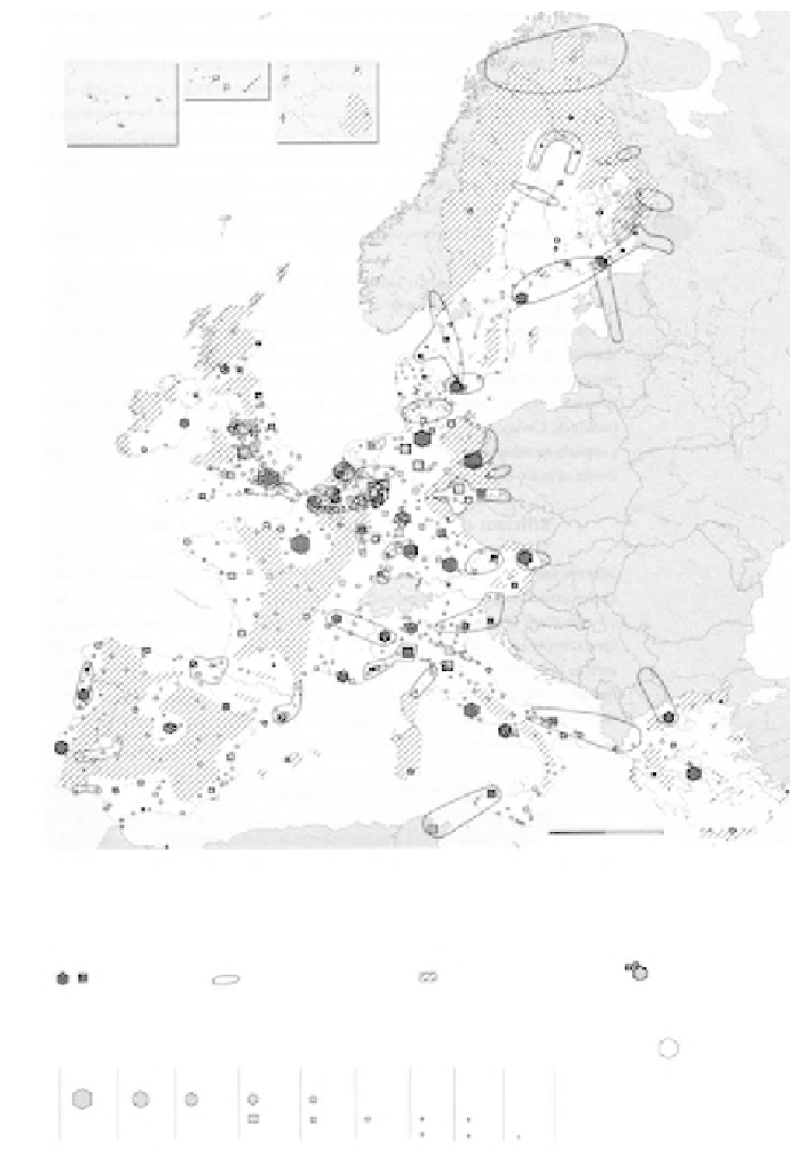
Geography Reference
In-Depth Information
Islas Canarias
Guadeloupe
La Réunion
Acores
Guyanne
(scale 50%)
Martinique
Madeira
scale 1: 12,000,000
0
250
500 km
Source: Eurostat. ESDP
N.B. This representation is only an illustration of certain spatial elements referred to in the text of the First Official
Draft of the ESDP, presented at the informal meeting of ministers responsible for spatial planning of the Member
States of the European Union in Noordwijk, 9/10 June 1997. They in no way reflect actual policy proposals and
there is no guarantee that the elements displayed here are exhaustive and entirely accurate.
gateway cities
(potential) cross-border
cooperation
relatively sparsely populated
areas
cities over-dependent
on a specific
economic sector
size in thousands of inhabitants
metropolitan
region
international level agglomerations
/cities
+ than
10,000
+ than
5,000
2,000
to 5,000
1,000
to 2,000
500
to 1,000
200 to
500
100 to
200
50 to
100
less
than 50
regional level towns
national level cities or large towns
Figure 5.2
Cartographic representation included in the first official draft ESDP: 'Diversity,
complementarity and co-operation'
Source: CSD (1997: annexe), original A3; reproduced in VROM (2000) in A4 size