Geography Reference
In-Depth Information
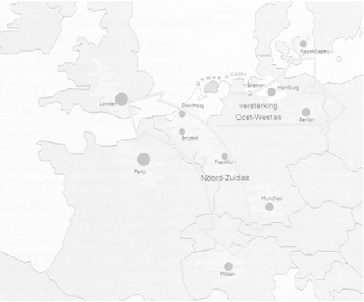
planning context, including the European, cross-border or national dimension, is
represented on a separate diagram. The 1994
Streekplan
for Friesland puts the
territory in the context of the 'Blue Banana' study which had been published a
few years earlier (see Figure 4.12). The cross-border context is also extensively
discussed in all
LEPs/LEPros
under study, and is cartographically represented
on a dedicated diagram in all three plans (cf. Figure 4.13). The European
context for planning is increasingly discussed and partly also cartographically
represented in English regional plans. In most cases, this is done with a diagram
showing the outlines of the United Kingdom and North-west Europe and the loca-
tion of the regional planning area, and sometimes the diagrams also include bound-
aries for European Structural Funds or Interreg funding. A notable exception to this
rather traditional approach to representing the European context is the Regional
Planning Guidance for the North East (RPG 1) (see Figure 4.14), which challenges
spatial positioning assumptions by showing that the distance between the North
East of England and Cornwall for instance is longer than that between the North
East and the Netherlands.
Figure 4.12
Friesland in the international context
Source: Provinciale Staten van Friesland (1994: 86)