Geoscience Reference
In-Depth Information
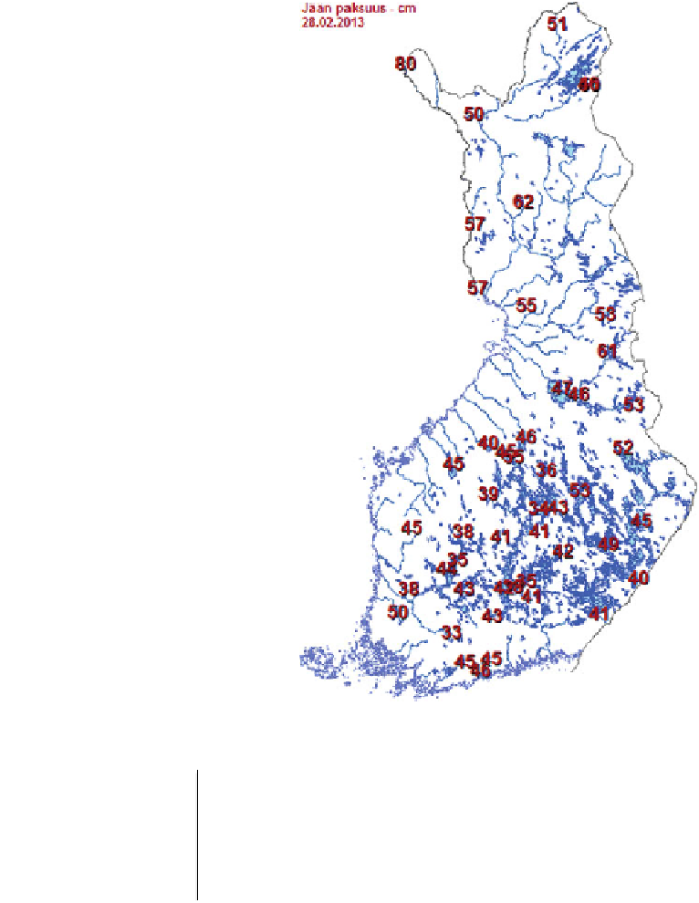
Fig. 8.4
Ice thickness (cm) in
Finnish lakes on February 29,
2014. This information is
available free to public in real
time. Ms. Johanna Korhonen,
Finnish Environment Institute.
Printed by permission
Table 8.1
Windows of electromagnetic radiation used in satellite remote sensing of lake ice
Window
Observed
Information
Optical
—
near-IR
Reflectance
Quality of surface (ice/snow/water)
Thermal IR
Surface temperature
Ice and snow thickness
Microwave radiation
Brightness temperature
Quality of surface (frozen/liquid)
Radar
Backscatter
Surface roughness, kinematics
The great advantage in ice mapping is the strong contrasts between frozen and liquid
surfaces across the electromagnetic spectrum from the visible light to microwaves.
Therefore the horizontal properties of an ice cover are well revealed but information in the
vertical direction is very small. The main limitation for remote sensing of lakes has been


Search WWH ::

Custom Search