Geology Reference
In-Depth Information
FIGURE 2.2
The Universal Transverse Mercator grid that covers the conterminous 48 United States comprises 10 zones—from Zone 10
on the west coast through Zone 19 in New England. Numbers at top of figure are degrees of longitude. (USGS)
the central N-S meridian in any zone. The central line
in any zone has a value of 500,000 meters to ensure
that all UTM eastings in a specific zone are reported as
positive numbers (Figure 2.3). Since there are 10 UTM
zones in the United States, it is important that the spe-
cific zone always be indicated. In the United States,
for instance, each zone may have identical values for
northing and easting; specifying the zone will allow
someone to determine if you are in Washington,
Minnesota, or Maine. Topographic maps indicate
UTM values along their margins shown as blue tic
marks.
Contour Lines
A distinctive characteristic of topographic maps is that
they portray the shape and elevation of the terrain
through the use of contour lines. The manner in which
contour lines express topography is illustrated in
Figure 2.4. Since contours are not ordinary lines, they
must meet certain criteria to satisfy their definition.
The following principles govern the use and interpre-
tation of contour lines.
1.
All points on a contour line have the same
elevation.
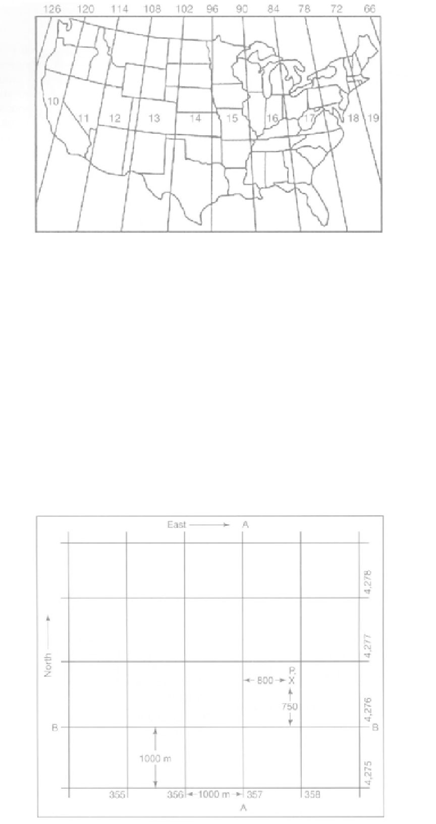
FIGURE 2.3
The grid value of line A-A is 357,000 meters east (of the zero line for that UTM zone). The grid value of line B-B is 4,276,000
meters north (of the equator), Point P is 800 meters east and 750 meters north of the grid lines; therefore, the grid coordinates of point P
are north 4,276,750 and east 357,800. (USGS)