Geology Reference
In-Depth Information
b.
if a category 2 hurricane hits land east of the town
3.
a.
How many named islands are there shown at Isles
Derniers in 1996?
What is the most westerly island?
c.
if a category 4 hurricane hits land west of the town
b.
How many major or large islands are shown on Figure
11.15a in 1887?
d. after the storm center has passed
c.
Was Isles Dernieres at one time a single long island?
2.
By 2100, it has been estimated that sea level may rise
between 1 and 3 feet.
a.
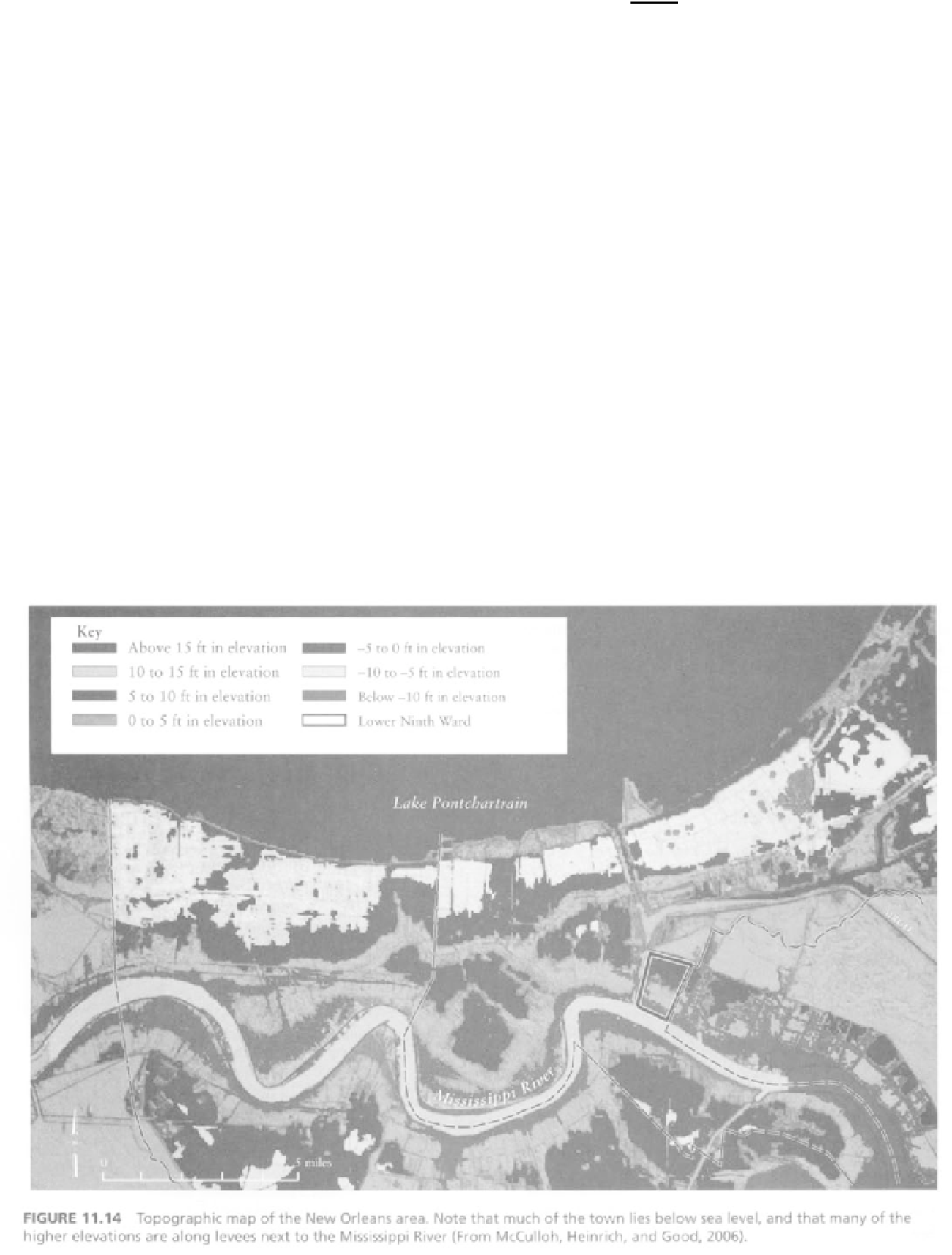
Refer to Figure 11.14 and identify on it additional areas
of New Orleans that are likely to be below sea level if a
3-foot rise takes place.
4. Which of the named islands appear to have lost the most
area since 1887?
~9
5. a.
In Figure 11.15b (aerial photo mosaic, 1996), identify the
following by marking them on the figure:
a sand beach
wetland
spit
shoal
b.
What likely impacts from hurricanes could be more
severe if a 3-foot rise in sea level takes place?
Examine Figure 11.15a, a map showing changes in Isles
Dernieres between 1887 and 1996 (and read the introduction
to the barrier islands part of this exercise) to help answer the
following. (Note: The Gulf of Mexico is on the south side of
the island.)
b.
What is a pass or coupe?
Figure 11.16 is a compilation of four different editions of the
West Derniere, Louisiana, quadrangle, beginning with one