Geology Reference
In-Depth Information
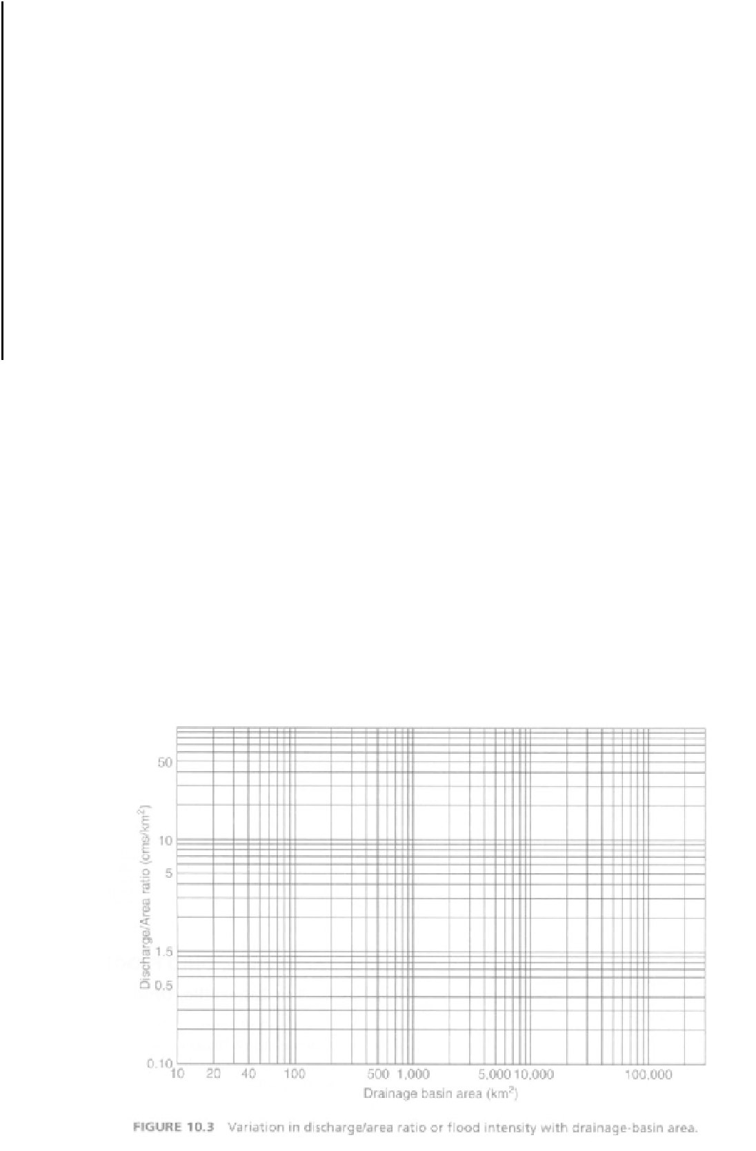
TABLE 10.3 Discharge/Area Ratios for 9 Rivers
Drainage Basin Area
(km
2
)
Drainage Basin Area
(km
2
)
Maximum Discharge,
Q (m
3
/s)
Maximum Discharge,
Q (m
3
/s)
Q/A Ratio (m
3
/s)/km
2
)
Q/A Ratio (m
3
/s)/km
2
)
River
Name
Location
Woallva
Hawaii
58
2,470
Yate
New Caledonia
435
5,700
Pioneer
Australia
1,490
9,840
Tam Shul
Taiwan
2,110
16,700
Eel Scotia
California
8,060
21,300
Han Koan
South Korea
23,880
37,000
Cheng Jiang
China
1,010,000
110,000
Lena
USSR
2,430,000
190,000
Amazon
Brazil
4,640,000
350,000
with snow. In a northeastward band extending from
Cincinnati through Columbus, 6 inches of rain fell on
January 20-21; more than half of the state received at
least 3 inches of rain (Edelen et al., 1964).
Flood-control reservoirs in some basins reduced
peak flows of some streams and prevented flood dam-
age. The Licking River, which discharges into the
Muskingum River at Zanesville (see Figure 10.4),
exhibited higher flood levels in 1959 than during the
1913 flood, although 5 miles upstream from their con-
fluence the stage of the 1913 flood was 4.5 ft higher
than that of the 1959 flood.
A stream-gaging station lies on the bank of the
Licking River 3.65 miles upstream from its mouth
and at an elevation of 683.7 ft (Figure 10.5 map in the
back of the topic). The maximum stage of the 1959
flood at this gage was 32.46 ft, which means that the
elevation of the flood at this point was 716.2 ft. Any
structure in the immediate area of the gaging station
and lower than this elevation would have suffered
flood damage.