Geology Reference
In-Depth Information
Exercise 9 • Subsidence
149
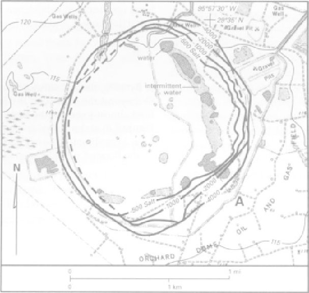
FIGURE 9.6
Subsidence topography above Orchard Salt Dome, Texas. Structural contours are the heavy solid or dashed lines (in feet
below sea level) on the surface of the salt dome, which is nearly vertical. "A" marks one of the open circles (a well). Spot elevations
and land surface contours are in feet.
(Modified from Mullican, 1988; used with permission of the UT Bureau of Economic Geology.)
1930
1950
1970
1990
Year
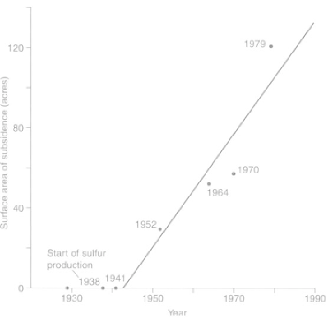
FIGURE 9.7
Change in surface area of the NE subsidence feature at Orchard Salt Dome, from inception to 1979. (Mullican, 1988, used
with permission of the UT Bureau of Economic Geology.)