Geoscience Reference
In-Depth Information
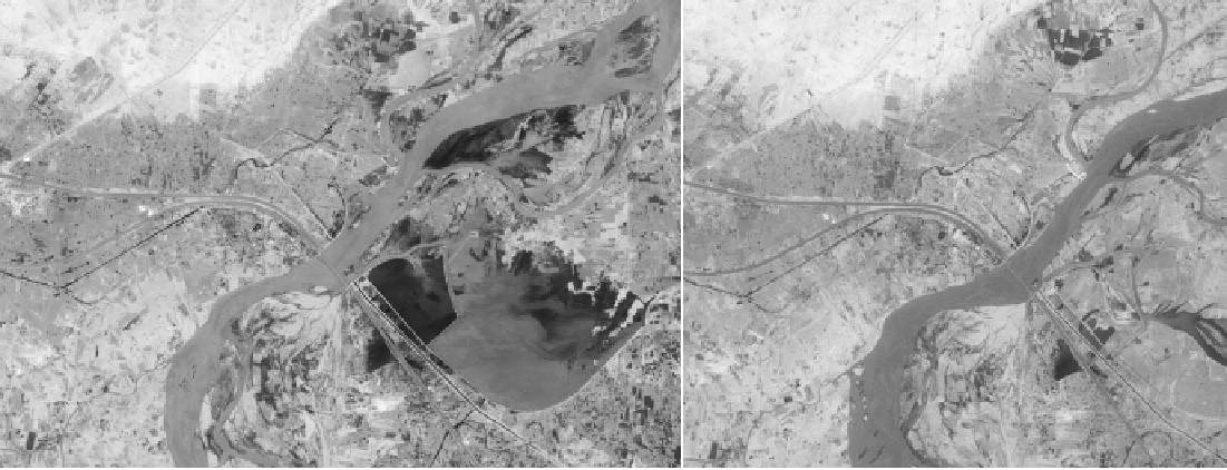
Figure 10.20.
Seasonal changes in the Indus River. Indus that irrigates an estimated 18 million hectares of farmland, experiences substantial fl uctuation
every year. Indus water is highly sensitive to variation in weather and climate and faces threat from climate change because of high dependency
on glacier water. The water levels are lower in June 2010 than in June 2009. The river is fed by glacial meltwater in the Himalaya and Karakoram
mountain ranges. Highest fl ow mostly between mid-July to mid-August, as rain and snow melt spike around the same time. The barrage (a type
of dam) is designed to control fl ow of water on the river and reduce the risk of fl ooding, supporting irrigation throughout the year. The river and
the irrigation infrastructure has been sustaining a population of millions. The Thematic Mapper on the Landsat 5 satellite observed these seasonal
changes in the Indus River 1st picture taken June 6, 2009 and the 2nd June 9, 2010 (NASA Earth Observatory).
Search WWH ::

Custom Search