Geography Reference
In-Depth Information
104˚
1˚30'
1˚30'
Johor
Baharu
Sembawang
Sungai Buloh
Estate
Namazie Estate
Kranji
Chong
Pang
Woodlands
Nee
Soon
Punggol
T ekong
Besar
Ama
Keng
Pulau
Ubin
Jalan
Kayu
Changi
Sungei
T engah
SINGAPORE ISLAND
Keat
Hong
Serangoon
Somapah
Serangoon
Changi
International
Airport
Bulim
Ang Mo Kio
Thomson
Bukit
Timah
Toa
Payoh
Jurong
Bedok
Holland
Village
Queenstown
Clementi
Pasir
Panjang
Merlimau
Singapore
T Telok
Blangah
Ayer Chawan
Ayer Merbau
Jurong
Islands
Sentosa
Bukum
SINGAPORE
Nongsa
Batu Ampar
Road
Railroad
City
Sekupang
Urbanized area
Jurong Reclamation Project
A
4
6 Kilometers
2
0
135
Tanjunguban
3
4 Miles
2
1
0
Bintan
Batam
Sagulung
Riau Islands
1˚
1˚
104˚
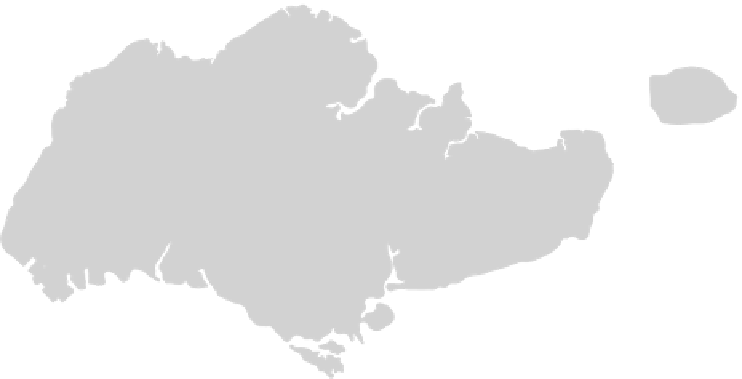
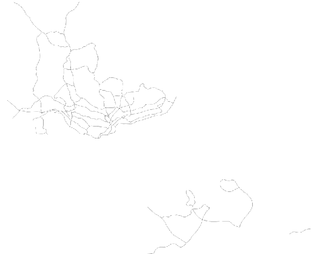
Figure 16-14
Singapore. Note how the urbanized area is oriented toward the sea.
From H. J. de Blij and P . O.
Muller,
Geography: Realms, Regions and Concepts
, 14th edition, p. 563. Originally rendered in color.
© H. J. de Blij and P . O. Muller. Reprinted with permission of John Wiley & Sons, Inc.
Sea-oriented Singapore was ill-prepared for a land
invasion and fell to the Japanese in February 1942. All
communities suffered greatly at the hands of the Japan-
ese during World War II, a fact that has contributed to a
legacy of distrust of Japan.
After the war, the British reoccupied the island. Al-
though its vision for Malaya was independence, it looked
upon Singapore quite differently . The British feared the
Chinese majority in light of the Communist takeover in
China in 1949 and the insurgence of communism in the
region. It was believed that an independent Singapore
would come under Communist control.
Limited self-government was introduced in 1955. In
1959, the People' s Action Party (PAP) began its dominance


Search WWH ::

Custom Search