Geography Reference
In-Depth Information
110
°
140
°
100
°
120
°
130
°
SOUTHEAST ASIA:
PHYSICAL GEOGRAPHY
Volcano
Glacier
200
400
600
800
1000 Kilometers
0
Shan
Plateau
Tonkin
Plain
0
100
200
300
400
500 Miles
20
°
Khorat
Plateau
o
r
Visayan
Islands
a
y
10
°
Kra
Isthmus
a
a
n
Spratly
Islands
Kinabalu
Malay
Peninsula
Borneo
Kalimantan
ahera
0
°
A
New
G
uinea
u
r
u
B
am
PAPUA
NEW
GUINEA
Merapi
Flores
10
°
Timor-Leste
or
d s
100
°
Longitude East of Greenwich
110
°
120
°
130
°
140
°
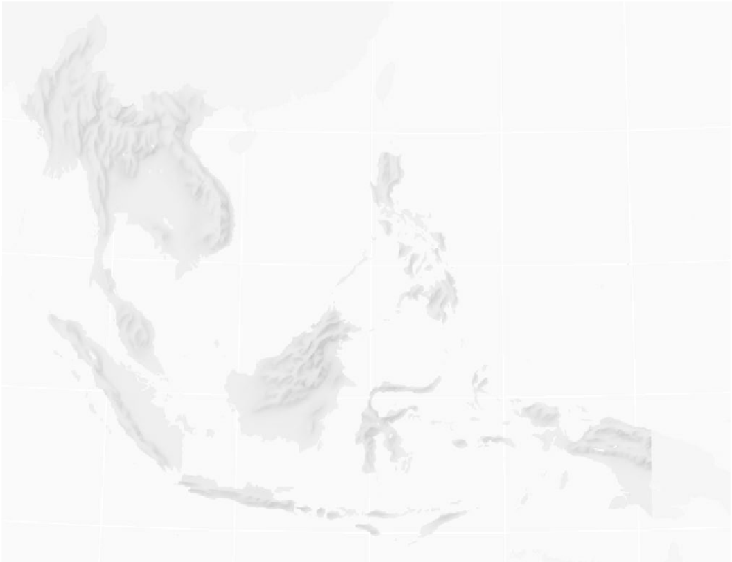
Figure 14-1
Physical features of Southeast Asia.
From H. J. de Blij and P . O. Muller,
Geography: Realms, Regions
and Concepts
, 14th edition, 2010, p. 534. Originally rendered in color. © H. J. de Blij and
P . O. Muller. Reprinted with permission of John Wiley & Sons, Inc.
tous in Thai and other cosmological representations.
The Khmer and numerous other Southeast Asian
civilizations are portrayed as emerging from water.
Sometimes whole populations have been identified
as the
naga
people. In almost everything of signifi-
cance, the
naga
symbol asserts itself.
Nagasin Southeast Asia
Naga
, in Sanskrit, means serpent. The
naga
is an
aquatic symbol that permeates the daily life of
people everywhere in the watery realm of Southeast
Asia (refer to Figure 1-2). The
naga
appears in art
form as a dragon and snake-like creature, and
frequently as a mutation of a different being. For
instance, Thailand has a
sang,
a cross between a
naga and a
singh
(lion). The
naga
form is ubiqui-
Mountain formation remains active and crustal in-
stability is a feature affecting the lives of millions (Chap-
ter 2). The 2004 earthquake off the northwest coast of


Search WWH ::

Custom Search