Geography Reference
In-Depth Information
XINJIANG UYGHUR AUTONOMOUS REGION
Under 50,000
50,000-250,000
250,000-1,000,000
1,000,000-5,000,000
Over 5,000,000
National capitals are underlined
82
°
86
°
90
°
94
°
98
°
R U
S S
I
Irrigated farming
Oilfields
Existing pipeline
Proposed pipeline
Road
Railroad
ahe
100
0
a)
Dun
d-Us
0
100
0
0
2
0
0
3
e
l i
M
0
0
4
Altay
74
°
78
°
Utubulak
u n g g
a r
y
a s i n
Manas
Changji
zi
Ürümqi
n
Turp
an
(T
(Turfan)
Korla
G A
I
H
C
Ruoqiang
(Qarkil
ik)
Le
k
a
t
u
Q I
N
G
74
°
78
°
82
°
86
°
90
°
94
°
Longitude East of Greenwich
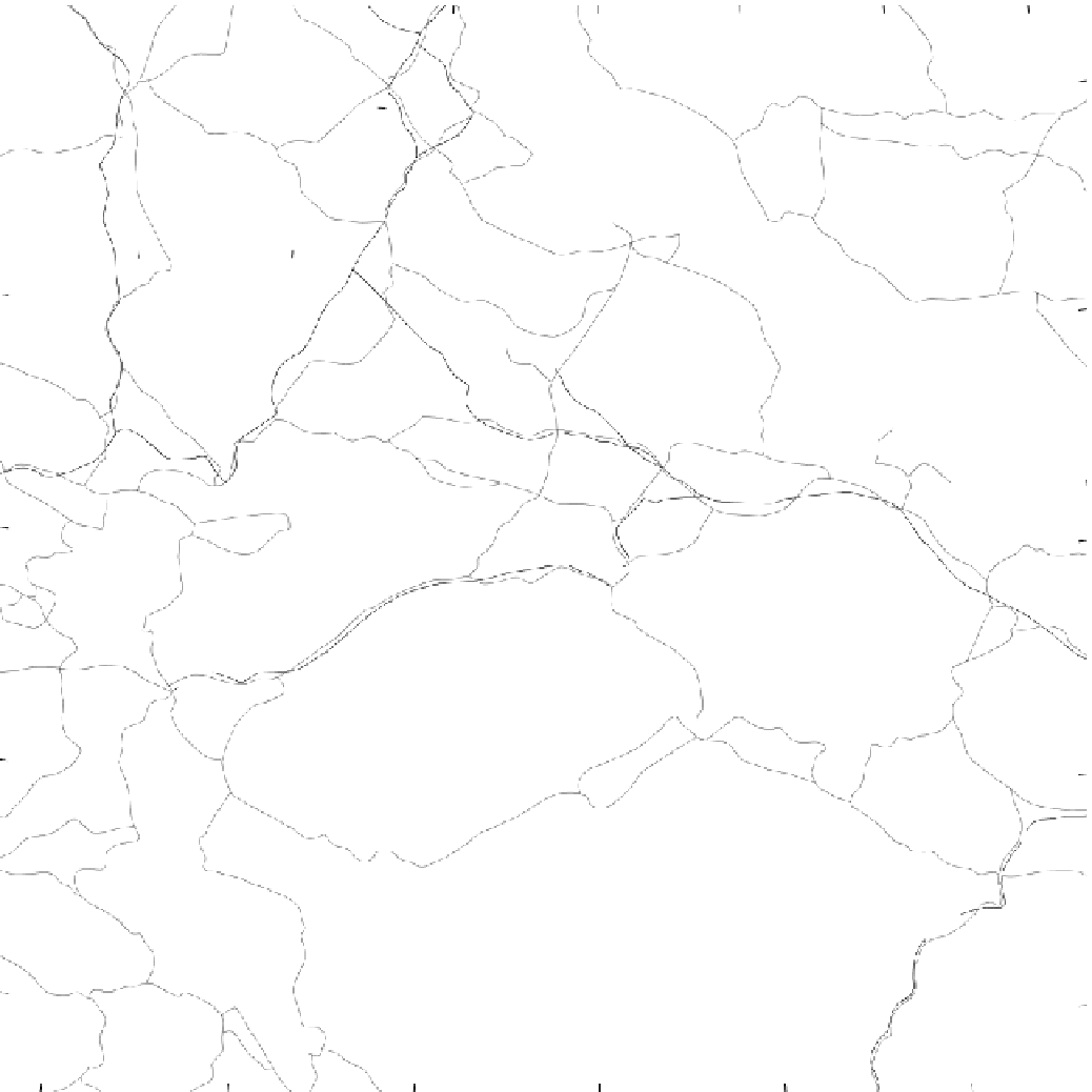
Figure 11-7
Xinjiang Uyghur Autonomous Region. Note how most of the irrigated farming areas are at the
base of mountain ranges. Ice melt feeds streams that flow down the slopes and typically disap-
pear beneath the desert sands to form oases. This water is tapped to irrigate crops and support
settlements. The silk route followed these oasis communities around the T Tarim Basin from
Gansu to Kashi (Kashgar).
From H. J. de Blij and P . O. Muller,
Geography: Realms, Regions, and
Concepts
, 14th Edition, 2010, p. 493. Originally rendered in color. Reprinted with permission of
John Wiley & Sons, Inc.


Search WWH ::

Custom Search