Geography Reference
In-Depth Information
70
°
80
°
90
°
100
°
110
°
120
°
130
°
140
°
A
nb
aatar
A
Ba
otou
Beijing
Tianjin
Taiyu
an
Xian
zh
ou
Chongqing
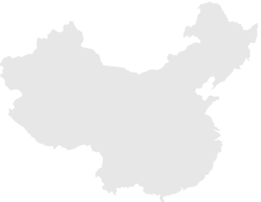
CHINA: ENERGY RESOURCES
AND SURFACE COMMUNICATIONS
X
iangg
Guan
gzhou
(Hong
Mac
u
Gasfield
Major road
Oilpipeline
Railroad
Oilfield
Manufacturing region
Coalfield
Major coal mine
0
300
600
900 Kilometers
300
0
10200
400
s
e
l i
M
0
0
5
100
°
110
°
Longitude East of Greenwich
120
°
130
°
Figure 11-3
Note how surface communications are concentrated in China proper . Why is China Frontier so
devoid of road and rail transportation?
From H. J. de Blij and P . O. Muller,
Geography: Realms,
Regions, and Concepts
, 14th Edition, 2010, p. 489. Originally rendered in color. Reprinted with
permission of John Wiley & Sons, Inc.
industry to the interior. At that time, egalitarianism in
regional development was deemed more important than
efficiency . In 1949, most industrial centers were concen-
trated in the northeast from southern Manchuria
through Shanghai. Subsequently , other centers were de-
veloped in line with discoveries of new resources such as
coal and oil. As a result, the share of industrial output in-
creased in the interior provinces. China' s single oil well
at Y umen became only one ofhundreds across the nation.
Xinjiang became a cornerstone of natural resource
exploitation (Figure 11-3).
Railroads were extended into the interior. No longer
was the network largely concentrated in northern and
northeastern China. New links were established between
north and south and extensions were built to the northwest
and southwest. Railroads, although built for strategic rea-
sons, were critical facilitators of population redistribution
in concert with the
hsia-fang
program and industrialization


Search WWH ::

Custom Search