Geography Reference
In-Depth Information
80
°
90
°
70
°
OF C
C
H
I
30
°
30
°
apu
SIKKI
M
N E P
A L
U T T A R
P R A D E S H
B H U T
Kathmand
u
L
ucknow
Patna
Pray
agraj
(Allahaba
d)
Varanasi
B A N
G L A
B I H A
R
P R A D
E S H
D H Y A
KHAND
D
haka
Ranchi
Jabalp
ur
Jams
hedpur
e
(Calc
R
a
i
p
B
Nag
pur
O R I S
S A
20
°
20
°
Bhubane
s
o
f
R A
V
ishak
hapa
tnam
PONDICHER
RY (UT)
wada
90
°
A
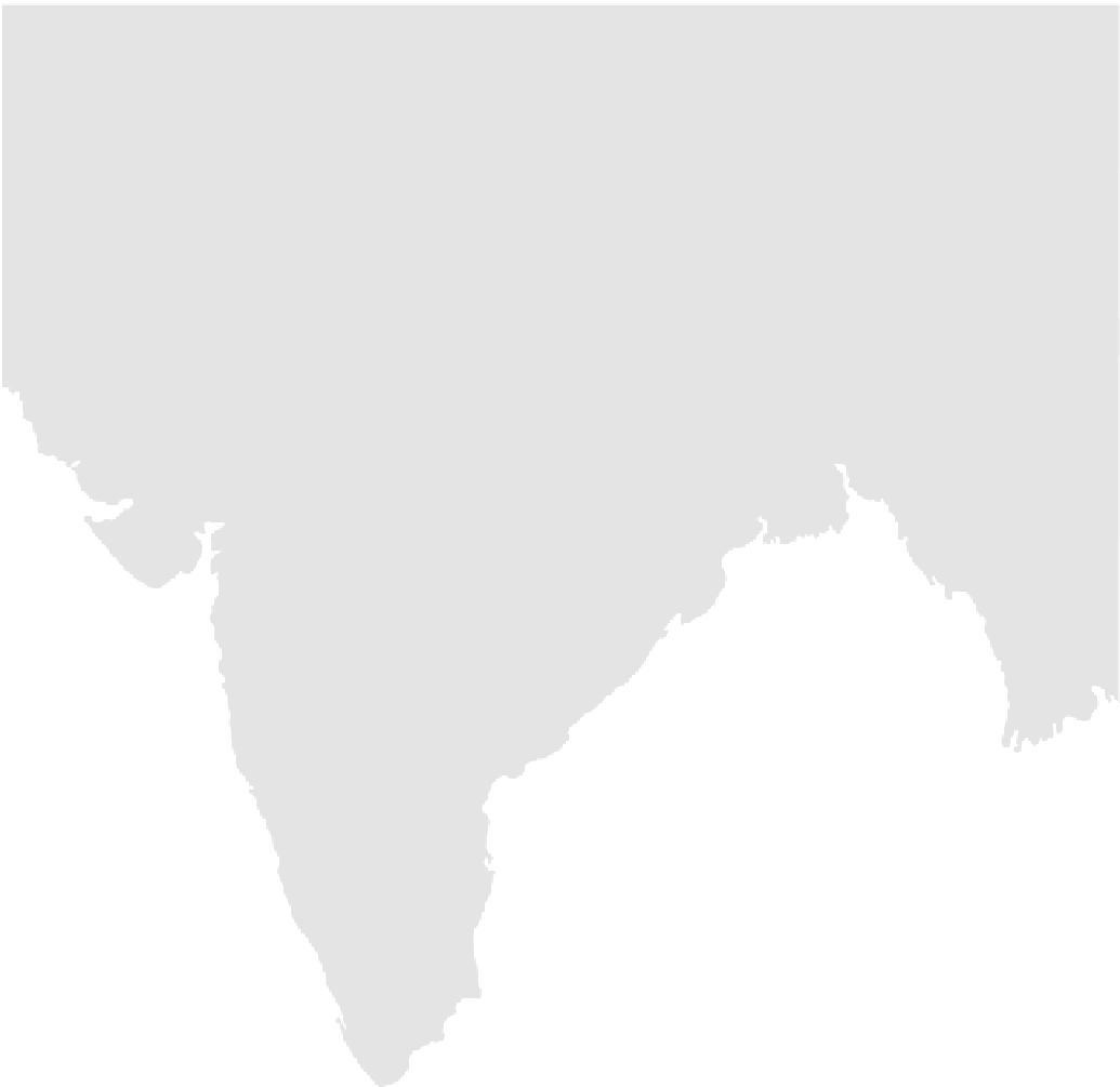
STATES OF INDIA
POPULATION
50,000-250,000
250,000-1,000,000
1,000,000-5,000,000
Chenn
ai
(Madras)
Over 5,000,000
imbatore
National capitals are underlined
PONDICHE
RRY (UT)
(UT)
Union T Territory
International border
claimed by China
Major railroad
Golden Quadrilateral
Superhighway
Indian culture hearth
Tiru
chchirapalli
10
°
10
°
rai
SRI
LAN
KA
O C E
A N
C
olombo
100
200
0
300
400
500
600
700 Kilometers
Sri Jayewardenepura Kotte
0
100
200
300
400 Miles
70
°
80
°
Longitude East of Greenwich
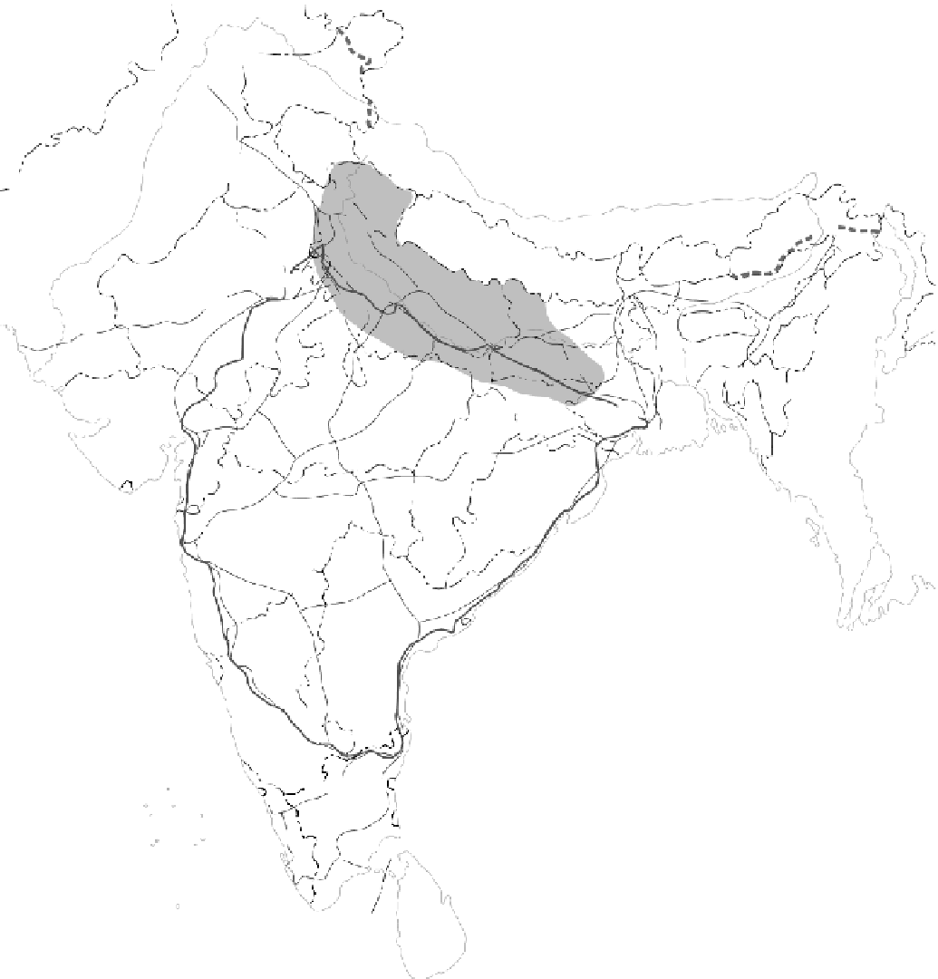
Figure 8-1
States and cities of India.
From H. J. de Blij and P . O. Muller,
Geography: Realms, Regions and
Concepts
, 14th edition, 2010, p. 428. Originally rendered in color. H. J. de Blij and P . O. Muller.
Reprinted with permission of John Wiley & Sons, Inc.


Search WWH ::

Custom Search