Geology Reference
In-Depth Information
where the deposition of alluvium has formed a broad
flood plain, there are many local topographic features
that project above the valley floor. South of Salem 14
isolated, rounded buttes are aligned in a north-south
direction along the east side of the valley. Volcanic in
origin, the buttes are composed of 30 to 35 million
year old basalts. The mineral and chemical composition
of the basalts as well as the age does not suggest any
association with the younger Columbia River lavas.
The most northerly of these features, Knox
Butte east of Albany rises 634 feet above the valley
floor. To the south near Lebanon, Peterson Butte, with
the highest elevation at 1,434 feet, differs from the
others in that it is a central volcanic vent with 12 dikes
radiating from the cone. Between Lebanon and Halsey,
Ward Butte, the small Saddle Butte, Powell Hills, Twin
Buttes, Bond Butte, as well as West Point Hill, Rock
Hill, and Lenon Hill near the Coburg ridge have an
average elevation just over 600 feet. West Point Hill,
Rock Hill, and Lenon Hill are spurs of resistant rock
from Western Cascade volcanics that extend into the
valley. The west face of Skinner Butte in downtown
Eugene with an elevation of 682 feet displays jointed
columnar basalt as does the 602 foot high Gillespie
Butte across the river. Spencer Butte dominates south
Eugene at 2,065 feet in height.
The origin of these buttes is still the subject of
controversy. In the past they have been interpreted as
volcanic necks, lava flow remnants, and laccoliths, but
in all probability they are sills. These are lense-shaped
bodies that intruded in the subsurface parallel to layers
of existing sediments where they cooled and hardened.
As the less resistant surrounding sediments are dissect-
ed by erosion, these rounded hills of basalt are exposed
as remnants.
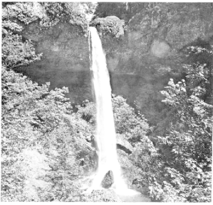
Silver Falls
Silver Falls State Park, the largest in the state,
covers 8,700 acres and is located 30 miles east of
Salem. Thirty million years ago the region around
Silver Falls was covered by coastal waters of a shallow
warm Oligocene ocean. Once the ocean had receeded
westward 15 million years ago, flows of basalt from
fissures in eastern Oregon repeatedly covered the area
with more than 600 feet of Columbia River lavas. In
the thousands of years between the volcanic events,
thick soils developed atop the flows. Eruptions of ash
and andesite lavas of the Fern Ridge Tuffs from
adjacent Cascade volcanoes later blanketed the region
before streams began to cut down through the layers.
The softer ash beds were quickly removed although
limited fragments of the layers remain in low spots
North Falls at Silver Falls State Park east of Salem drops 136 feet from a lip of Miocene basalt to a
plunge pool cut into Oligocene marine rocks (photo courtesy Oregon State Highway Department).