Geology Reference
In-Depth Information
Prior to each flood, an ice lobe from northern
Idaho stretched southwest to dam up the Clark Fork
River that flows northward to join the Columbia across
the Canadian border. Old shorelines visible today high
above the city of Missoula, Montana, are evidence that
the ice dam backed up a vast lake covering a large area
of western Montana. As the ice dam was breached,
water, ice, and sedimentary debris poured out at a rate
exceeding 9 cubic miles per hour for 40 hours. Flushing
through the Idaho panhandle and scouring the area
now known as the channeled scablands of southeast
Washington, the lake drained in about 10 days.
After crossing eastern Washington, the water
collected briefly at the narrows of Wallula Gap on the
Oregon border where blockage produced the 1,000 foot
deep Lake Lewis. Ponding up a second time at The
Dalles to create Lake Condon, the rushing water
stripped off gravels and picked up debris, steepening
the walls of the Columbia gorge. Near Rainier the river
channel was again constricted causing flood waters to
back up all the way into the Willamette Valley. At
Crown Point flood waters spilled south into the Sandy
River drainage and across the lowland north of Van-
couver taking over the Lacamas Creek channel. Most
of the water exited through the gorge to the ocean, but
as much as a third spread over the Portland region to
depths of 400 feet. Only the tops of Rocky Butte, Mt.
Tabor, Kelly Butte, and Mt. Scott would have been
visible above the floodwaters. Surging up the ancestral
Tualatin River, the waters covered the present day site
of Lake Oswego to depths over 200 feet, while Beaver-
ton, Hillsboro, and Forest Grove would have been
under 100 feet of water.
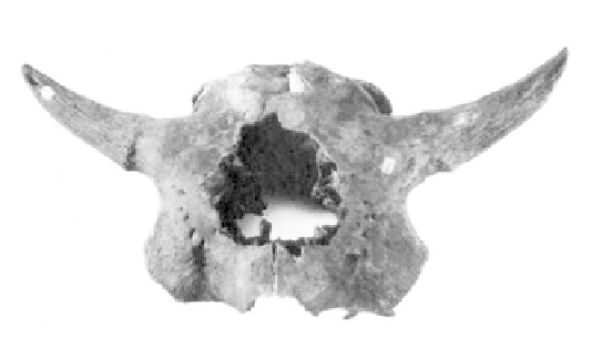
Skulls and skeletal elements of Ice Age bison up to
8 feet high at the shoulder are common in
Willamette Valley swamp deposits (specimen from
the Thomas Condon Collection, Univ. of Oregon).
canyon and tributary streams high in the upper water-
shed. The amount of water in a single flood, estimated
at up to 400 cubic miles, is more than the annual flow
of all the rivers in the world. The natural reservoir of
Lake Missoula filled and emptied repeatedly at regular
intervals suggesting that natural processes were regulat-
ing the timing of the floods. Once the lake had filled to
a certain level, it may have floated the ice lobe or
glacial plug that jammed the neck of the valley which,
in turn, released enough water to allow the flooding
process to begin.
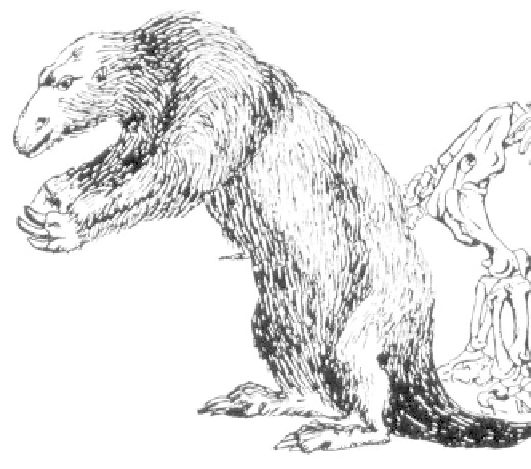
Swampy lowlands in the Willamette Valley yield the
bones of the enormous Ice Age ground sloth.