Geology Reference
In-Depth Information
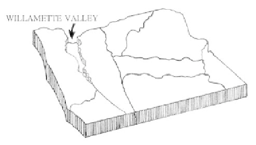
Willamette Valley
Physiography
The Willamette Valley and Puget Sound
physiographic province is a lowlands stretching from
Cottage Grove, Oregon, to Georgia Strait in Washing-
ton. The smallest physiographic division in Oregon, the
valley is a level, elongate alluvial plain which narrows
at either end for 30 miles before it pinches out. En-
closed on the west by the Coast Range, on the east by
the Cascade Mountains, and bordered on the north by
the Columbia River, the main valley is 130 miles long
and from 20 to 40 miles wide. From 400 feet at the
southern end of the valley near Eugene, the elevation
drops to sea level at Portland, an average of 3 feet per
mile. The overall gradient is to the north and not from
the margins toward the middle. The southern end of
the valley is narrower but flatter than the northern
hilly Salem and Portland areas. Salem is bordered by
the Eola Hills to the west, the Ankeny Hills to the
south, and the Waldo Hills to the east. The 1,000 feet
high Tualatin Mountains are adjacent to Portland on
the west, the Chehalem Mountains cross to the south-
west, while to the east and southeast smaller volcanic
buttes and peaks dot the landscape. Near the center of
the valley, the 45th parallel, halfway between the
equator and the North Pole, passes close to Salem.
With a watershed of 11,200 square miles, the
Willamette River is the major waterway in the valley.
Originating at the junction of the Coast and Middle
forks near Eugene, the river runs north-northeast to its
confluence with the Columbia. Flowing into the
Willamette, sediment laden waters of the Coast and
Middle forks from the south, the McKenzie, Calapooia,
North and South Santiam, Pudding, Molalla, and
Clackamas rivers from the Cascade Mountains, and the
Long Tom, Marys, Luckiamute, Yamhill, and Tualatin
rivers from the Coast Range drain the surrounding
areas.
Geologic Overview
Physiologically the Willamette-Puget Sound
lowland is similar to the Great Valley of California, but
geologically the two are significantly different. The
California valley was at one time an inland sea behind
the Coast Range, whereas the Oregon province was
part of a broad continental shelf of the ocean extending
from the Cascades westward beyond the present coast.
Structurally the Willamette Valley was more of a
coastal marine environment than a true isolated basin
or a valley cut by a river. Although subsurface geology
of the Willamette Valley is closely related to that of
the Coast Range, the later history of the valley is
primarily one of glacial events. Thick layers of Late
Pleistocene and Holocene alluvium cover all but a few
areas of preTertiary rock from Eugene to Portland.
Older foundation rocks here are volcanics that
erupted as part of a submarine oceanic island archipel-
ago. Once the archipelago was attached or accreted to
the western margin of North America, the volcanic
rocks subsided, and a forearc basin formed on top. This
basin was to become the focus of marine deposits from
the Eocene through Pliocene. Fossils and sediments
accumulating in the basin during the Oligocene,
Although comparatively small, the Willamette
Valley is the economic and cultural heart of Oregon.
As the only natural lowland of any size, its moderate
climate supports 70% of Oregon's population as well
as intense and varied agriculture.
203