Geology Reference
In-Depth Information
Arch Rocks were most likely tunnels at one time.
Today these offshore rocks are inhabited by countless
marine birds and sea lions.
To minimize hazards to shipping from the
projecting rocks, a lighthouse was constructed in 1890
on the longest headland at Cape Meares. Sheet iron
and bricks that were formed and baked on site at the
cape were used in the building. The unusual lens in the
lighthouse has eight sides, four with deep red panes
and four with white ones, capable of projecting a beam
21 miles to sea. The only other light of this type
operates in the Hawaiian Islands. The giant lens,
weighing more than a ton, was ground in France,
shipped around Cape Horn, and hoisted up a 200-foot
cliff using a crane made from local spruce trees. An
older oil-vapor lamp replaced the original 5 wick
kerosene lantern, and in 1934 electricity reached the
cape. The lighthouse was taken out of service in 1963.
Wave action at Tillamook Head separated the
100 foot high Tillamook Rock, an offshore basalt sea
stack, from the mainland. One of Oregon's largest
coastal monoliths, Tillamook Head is a complex of
Miocene basalts and Astoria Formation sediments
eroded into headlands, coves, stacks, and arches. Two
promontories, connected by a crescent-shaped indenta-
tion, make up the 1,136 foot high Tillamook Head. The
famous lighthouse atop Tillamook Rock was built in
1878 with material shipped in and landed by derricks.
Improved navigation brought about the closure of the
lighthouse in 1957. Purchased by Las Vegas business-
men in 1959, it remained vacant until 1980 when a
Portland real estate consortium bought the island to
remodel the lighthouse structure for use as a columbar-
ium.
Elephant Rock, an elongate knob of basalt at Seal
Rocks State Park (photo courtesy Oregon Dept.
Geology and Mineral Industries)
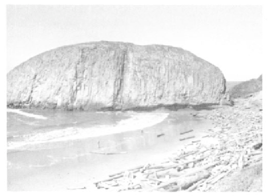
Yaquina Point, Cape Foulweather, Cape Lookout,
Cape Meares, Cape Falcon, and Tillamook Head are
all of resistant exposures of Miocene Columbia River
Basalt. Cape Kiwanda, which is bracketed by softer
sediments, and Cascade Head, composed of local
basalts, are the exceptions. Covering about 7 square
miles between Neskowin Creek and Salmon River,
Eocene basalt from a volcanic vent forms Cascade
Head, rising 760 feet above the sea surface. Proposal
Rock, now a tree covered island, was once part of
Cascade Head before being cut off from the coast.
Cape Kiwanda is unusual in that it is made of resistant
sedimentary rocks of the Astoria Formation. Offshore
Haystack Rock of Miocene basalt protected the head-
land from erosion until it was separated from the cape
by wave action. Since that time the cape has receeded
to its present position.
Jutting dramatically for three-fourths of a mile
from the shore north of Cape Kiwanda, the narrow
Cape Lookout is composed of Miocene basalts. Be-
cause the layers that make up the cape are tilted
toward the north, the sheer cliffs to the south are 800
high, while those to the north rise only 400 feet.
Maxwell Point and Cape Meares are also part of the
same invasive Columbia River basalt flows. A pocket
beach is located between the smaller southern lobe at
Maxwell Point and the more northerly projection at
Cape Meares. Sands in these pocket beaches are
protected from erosion by dominant headlands. Here
three points of rock, separated by deep coves, rise
vertically to elevations of 400 feet. The sea stacks,
knobs, and arches of Pillar Rock, Pyramid Rock, and
Three Arch Rocks offshore from Cape Meares and
Maxwell Point are remnants of Columbia River basalt
flows once connected to the mainland. Of these, Three
Caves and Trenches
Rocks, with fractures and faults running
through them, have been eroded as caves, trenches, and
tunnels seen in coastal areas. As waves flush away
softer zones of rock along the faults, long straight
trenches or caves result. When the roof collapses, as
happens frequently, a churn, punchbowl, or water spout
may develop. Between Sunset Bay and Cape Arago,
narrow trenches and chasms are common. At Shore
Acres State Park, the roof of a cave has collapsed
leaving a natural bridge. Tunnel Point, the sharp
headland immediately west of Coos Head, once had a
natural tunnel and cave created by erosion of the sea
cliff. Devils Elbow near Heceta Head and Devils Churn
south of Neptune State Park are sea caves where the
roof has collapsed along a trench that terminates in a
cave beneath the headland. The tunnel at Devils Elbow
extends 600 feet through Eocene Yachats Basalt. Near
Neptune State Park, what was once a sea cave or