Geology Reference
In-Depth Information
during 1983, and within 5 weeks the opening to Alsea
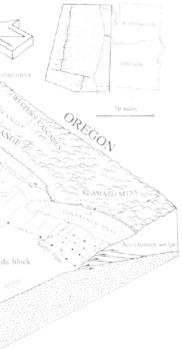
systems, and the Oregon coastal margin is no excep-
Bay had widened to over 1,900 feet by shifting erosion-
tion. Sedimentary formations ranging from Eocene
al patterns. Houses on the the spit as well as the city
through Pleistocene exposed in the Coast Range can be
of Waldport were threatened. At Netarts Bay, the long
traced offshore where the oldest sediments on the
narrow sand bar jutting northward from Cape Lookout
continental shelf grade into younger deposits on the
is forested in the central section, but the north end is
slope.
bare and subject to erosion.
The continental margin of the offshore shelf,
slope, and abyssal plain are broken by features as
Offshore Continental Shelf and Slope
banks, ridges and basins, canyons, and channels. On
The continental shelf and slope are of increas-
the outer edge of the shelf, prominent submarine fault-
ing importance as available technology makes explora-
bounded escarpments as Nehalem, Stonewall, Perpetua,
tion and exploitation easier, and the search for food,
Heceta, and Coquille banks are exposed Miocene
fossil fuels, and metals expands into the ocean basins.
through Pliocene mudstones, sandstones, and clays that
The edge of the continent does not stop at the beach
project as much as 200 feet above the surrounding
but extends to the shelf that dips gently seaward to a
seafloor. The steep escarpment at Stonewall Bank is
depth of 600 feet. The steeper continental slope
situated approximately 19 miles off Yaquina and Alsea
descends to abyssal seafloor depths of 9,000 feet below
bays in water less than 120 feet deep. Another subma-
sea level. The combined width of the shelf and slope is
rine projection, Heceta Bank lies about 35 miles west
approximately 70 miles off Astoria and 40 miles off
of the mouth of the Siuslaw River and rises within 360
Cape Blanco. Shelf and slope geology adjacent to
feet of the surface, while Coquille bank, a shoal
continents are linked directly to onshore geologic
approximately 3 miles wide and 8 miles long between
Coos Bay and Cape Blanco, exhibits 198 feet of relief.
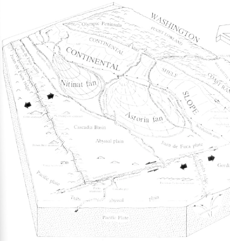
Physiography and structure of
the continental slope and
abyssal plain off Oregon and
Washington.