Geology Reference
In-Depth Information
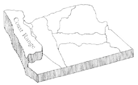
Coast Range
Physiography
A long narrow belt of moderately high moun-
tains and coastal headlands, the Oregon Coast Range
physiographic province extends from Washington state
and the Columbia River in the north to the Middle
Fork of the Coquille River in the south and from the
continental shelf and slope to the western edge of the
Willamette Valley. Just over 200 miles long and from
30 to 60 miles wide, the province narrows in the center
and widens on either end. The crest of the range
averages 1,500 feet in altitude with the highest point
Marys Peak near Philomath reaching 4,097 feet. Saddle
Mountain east of Seaside at 3,283 feet, Trask Mountain
at 3,423 feet northwest of McMinnville, and Sugarloaf
Mountain at 3,415 feet east of Lincoln City are among
the highest of the interior peaks.
Because there is more rainfall, steeper gradi-
ents, and more active erosion on the western slope,
summits of the passes lie well to the east of the axis of
the range. With the close marine influence, the coastal
region has the highest average winter temperatures, the
coolest summers and the greatest rainfall in Oregon.
The western slopes of the mountains receive over 100
inches of rain a year, while east slope precipitation
averages only around 30 inches. High rainfall and mild
temperatures have contributed to a heavy forest with
thick vegetation and mature soils covering most of the
range.
entirely across the province to empty into the ocean.
The notable west flowing rivers, the Nehalem, Wilson,
Siletz, Yaquina, Alsea, Siuslaw, Umpqua, Coos, and
Coquille, end in broad tidal estuaries. Of those streams
flowing eastward into the Willamette River, most have
less extensive watersheds. Among them, the Long Tom,
Marys, Luckiamute, Yamhill, and Tualatin rivers are
the largest.
The Coast Range province continues offshore
to the continental shelf and slope that descends to the
abyssal plain at 9,000 feet below sea level. The surfaces
of the shelf and slope are broken by high bedrock
scarps, ridges, basins, and canyons. The most significant
offshore feature is the subduction zone beneath the
base of the continental slope where the Farallon plate
is sliding under the North American landmass.
Along the western shore of the Coast Range
the line of abrupt coastal headlands is fairly evenly
interspersed with shallow bays, estuaries, pocket
beaches, and sand dunes. Cape Blanco in the southwest
corner of the province is a distinctive terraced promon-
tory that extends into the Pacific Ocean as Oregon's
most westerly point. Extensive sands are present
between Coos Bay and Heceta Head and from Seaside
to the Columbia River. Sand has accumulated as bars
or spits across the mouths of most rivers hindering the
flow of water in and out of the bays. Along the very
southwestern edge of the province, wave-cut terraces
create a narrow coastal plain with remnants of older
marine terraces rising up to 1,600 feet.
Rowing west to the ocean or east to the interi-
or, most of the streams of the Coast Range are small.
Only the Columbia, Siuslaw, and Umpqua rivers cut
Geologic Overview
At
the end of the Cretaceous period, 66
million years ago, Oregon lacked a coastal mountain
range, and the ocean shoreline extended diagonally
across eastern Washington and Idaho. Southeast of this
large embayment the newly formed Klamath Mountains
projected well into Idaho. A loose chain of volcanic
seamounts was forming in the ocean setting to the west
where an active hot spot lay beneath a spreading center
167