Geology Reference
In-Depth Information
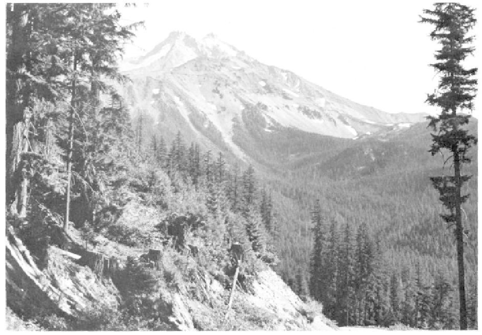
The 10,495-foot high Mt. Jefferson, located in the central portion of the Oregon Cascade range, is the
second highest peak in the state (photo courtesy Oregon State Highway Department).
extending from California into British Columbia, began
to form during the Pliocene when voluminous outpour-
ings of lava from broad shield volcanoes built up along
the eastern flanks of the older Western Cascades. Over
a period of millions of years these volcanoes were worn
down by erosion only to have later eruptions during
the Pleistocene construct the volcanic peaks seen today
in the same north-south alignment.
Thin, sharp remnants of the older, eroded
Quaternary volcanoes, Mt. Jefferson, Three Fingered
Jack, Mt. Washington, the North Sister, Broken Top,
Mt. Thielsen, Mt. McLoughlin, and several other less
conspicuous peaks are easy to distinguish from the
later conical-shaped mountains. Of the dramatic
younger volcanoes, Mt. Hood, Mt. Bachelor, the South
Sister, and Mt. Mazama, now known as Crater Lake,
although eroded to a degree, still retain much of the
original composite cone-shape. Brown Mountain, 10
miles southeast of Mt. McLoughlin, Tumalo Mountain
near the Three Sisters, and numerous low mounds near
Mt. Hood erupted as small volcanoes on the flanks of
the higher peaks.
Cascade range is Mt. McLoughlin at 9,493 feet near the
Oregon border. Formerly called Mt. Pitt, this peak was
renamed for John McLoughlin, benefactor to early
travellers in Oregon and factor of Hudson's Bay
Company. Severe glacial erosion, which has carved out
a distinct semi-circular basin or cirque in the northeast
slope of Mt. McLoughlin, suggests this mountain is
probably not one of the younger Cascade peaks. The
first eruptions of Mt. McLoughlin may have occurred
over 100,000 years ago, and two or three succeeding
eruptions built up the cone and surrounding blocky
lava flows. In the final stages, andesite lavas oozed
from fissures along the base of the main cone and not
from the main conduit.
Crater Lake
Oregon's most cataclysmic geologic event took
place about 6,900 years ago when Mt. Mazama explod-
ed then collapsed to create the symmetrical caldera of
Crater Lake. One of the most serene sights in Oregon
today, the crater and surrounding 160,290 acres in
Klamath County were declared Crater Lake National
Park in 1902. The geologic history of Crater Lake, as
recorded in the walls of the caldera, began during the
Pleistocene 400,000 years ago with the construction of
Southern High Cascades
The southern-most cone in the Oregon High